Sign up for our Newsletter


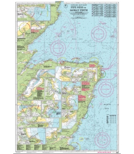
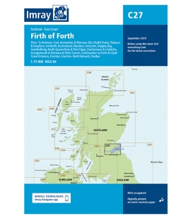
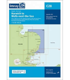
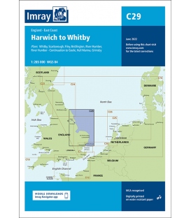
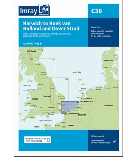
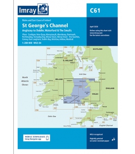
Imray Chart C61 St George's Channel


Scale: 280000
Paper Size: 36.0" x 48.0"
Actual Chart Size: 31.0" x 44.0"
Edition Date: 2020-04-01
Online Chart Viewer
Imray Chart C61 St George's Channel
Anglesey to Dublin, Waterford and the Smalls
Scale: 1:280,000 WGS 84
Wales to the East Coast of Ireland
Plans included:
Cardigan (1:40 000)
New Quay (1:20 000)
Aberystwyth (1:20 000)
Aberdovey (1:50 000)
Barmouth (1:30 000)
Porthmadog (1:75 000)
Tremadog Bay (1:75 000)
Menai Strait (1:80 000)
Menai Strait - The Swellies (1:25 000)
Conwy (1:30 000)
Dun Laoghaire (1:25 000)
Dublin Bay (1:90 000)
Wicklow (1:10 000)
Arklow (1:15 000)
Wexford (1:75 000)
On this edition the chart specification has been improved to show coloured light flashes. The firing practice areas have been updated and the extents of the Skomer I. Marine Reserve is shown. There has been general updating throughout.