Sign up for our Newsletter


Imray Chart C41 Les Sables d'Olonne to La Gironde
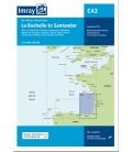
Scale: 110000
Paper Size: 36.0" x 60.0"
Actual Chart Size: 31.0" x 56.4"
Edition Date: 2017-06-01
Online Chart Viewer
Imray Chart C41 Les Sables d'Olonne to La Gironde
Scale: 1:110,000 WGS 84
Plans included:
Bourgenay (1:10 000)
Approach to Jard-sur-Mer (1:17 500)
Approach to Ars-en-Ré (1:40 000)
Approach to St Martin-de-Ré (1:15 000)
Approach to La Flotte-en-Ré (1:15 000)
Rade de la Pallice (1:40 000)
La Rochelle and Port des Minimes (1:15 000)
St-Denis-d’Oléron (1:10 000)
Douhet (1:7500)
Boyardville (1:10 000)
Rochefort (1:10 000)
Royan (1:7500)
Port Médoc (1:12 500)
La Gironde & La Garonne (1:200 000)
Continuation to Bordeaux (1:200 000)
On this edition the latest depth surveys have been applied where available. Harbour and marina development at Port Minimes and La Pallice are included as is the latest information on nature and marine reserves. The La Gironde to Bordeaux plan has improved detail and increased usability. The chart specification has been improved to show coloured light flashes. There has been general updating throughout.