- Home
- >
- Nautical Charts
- >
- Imray-Iolaire Nautical Charts
- >
- North Atlantic Ocean Region
- >
- Imray Chart C50 Sines to Gibraltar
Categories
- CLEARANCE
- New Editions
- Nautical Charts
- Nautical Books
- E-Readers & E-Books
- Occupational Safety & Health Administration (OSHA)
- Destinations
- Code of Federal Regulations (CFR)
- USCG Exam Study Materials
- International Maritime Org. (IMO)
- Sealite Aids to Marine Navigation
- Flags
- Digital Charts
- Nautical Software
- Marine Supplies
- Navigation Equipment
- Intracoastal Waterway
- Ocean Cruising
- Great Circle Route
- Gift Shop


Sign up for our Newsletter
II-C050
New product
Scale: 350000
Paper Size: 36.0" x 48.0"
Actual Chart Size: 31.0" x 44.0"
Edition Date: 2017-03-01
Online Chart Viewer
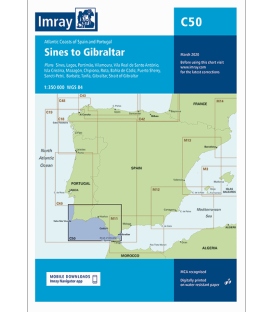
Imray Chart C50 Sines to Gibraltar
Scale: 1:350 000 WGS 84
Plans included:
Sines (1:30 000)
Lagos (1:30 000)
Portimão (1:25 000)
Vilamoura (1:20 000)
Vila Real de Santo António (1:35 000)
Isla Cristina (1:30 000)
Mazagón (1:40 000)
Chipiona (1:40 000)
Rota (1:25 000)
Bahía de Cádiz (1:55 000)
Puerto Sherry (1:30 000)
Sancti-Petri (1:30 000)
Barbate (1:75 000)
Tarifa (1:20 000)
Gibraltar (1:40 000)
Strait of Gibraltar (1:275 000)
On this the latest depth surveys have been applied. Harbour developments in Gibraltar are included as are the latest firing practice areas in Golfo de Cadiz. The chart specification has been improved to show coloured light flashes. There has been general updating throughout.
Reviews
30 other products in the same category:
- About Us
- Our Services
- Ordering & Shipping
- Resource Links
- Blog
- CLEARANCE
- New Editions
- Nautical Charts
- Nautical Books
- E-Readers & E-Books
- Occupational Safety & Health Administration (OSHA)
- Destinations
- Code of Federal Regulations (CFR)
- USCG Exam Study Materials
- International Maritime Org. (IMO)
- Sealite Aids to Marine Navigation
- Flags
- Digital Charts
- Nautical Software
- Marine Supplies
- Navigation Equipment
- Intracoastal Waterway
- Ocean Cruising
- Great Circle Route
- Gift Shop


