Sign up for our Newsletter


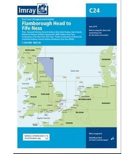
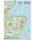
Imray Chart C24 Flamborough Head to Fife Ness
Scale: 250000
Paper Size: 36.0" x 48.0"
Actual Chart Size: 31.0" x 44.0"
Edition Date: 2018-06-01
Online Chart Viewer
More info
Imray Chart C24 Flamborough Head to Fife Ness
Scale: 1:250 000 WGS 84
Plans included:
Eyemouth Harbour (1:7500)
Berwick Harbour (1:12 500)
Holy Island Hbr (1:17 500)
Farne Islands (1:90 000)
Warkworth Harbour (Amble) & Approaches (1:22 500)
Blyth Harbour (1:10 000)
River Tyne (1:25 000)
Continuation of the River Tyne (1:40 000)
River Tyne - Further continuation to Newcastle (1:40 000)
Sunderland Harbour (1:15 000)
Seaham Harbour (1:12 500)
Hartlepool (1:20 000)
River Tees (1:30 000)
Whitby (1:15 000)
On this edition a the chart specification has been improved to show coloured light flashes. There has been general updating throughout.