- Home
- >
- Nautical Charts
- >
- Imray-Iolaire Nautical Charts
- >
- North Atlantic Ocean Region
- >
- Imray Chart C3 Isle of Wight
Categories
- CLEARANCE
- New Editions
- Nautical Charts
- Nautical Books
- E-Readers & E-Books
- Occupational Safety & Health Administration (OSHA)
- Destinations
- Code of Federal Regulations (CFR)
- USCG Exam Study Materials
- International Maritime Org. (IMO)
- Sealite Aids to Marine Navigation
- Flags
- Digital Charts
- Nautical Software
- Marine Supplies
- Navigation Equipment
- Intracoastal Waterway
- Ocean Cruising
- Great Circle Route
- Gift Shop


Sign up for our Newsletter
II-C003
New product
Scale: 52,500
Paper Size: 36.0" x 46.0"
Actual Chart Size: 29.7" x 42.2"
Edition Date: 2022-04-01
Online Chart Viewer
More info
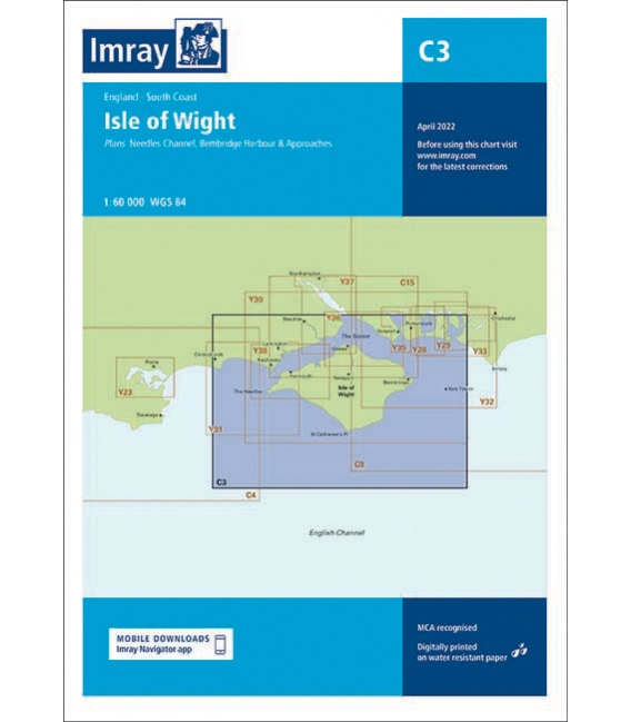
Imray Chart C3 Isle of Wight
Scale: 1:52,500 WGS 84
Plans included:
Lymington River (1:17 500)
River Hamble (1:20 000)
Bembridge Harbour (1:20 000)
The chart is designed to be used alongside C15 The Solent for combined coastal navigation, approach, and harbour detail in and around the Solent and Isle of Wight.
Reviews
30 other products in the same category:
- About Us
- Our Services
- Ordering & Shipping
- Resource Links
- Blog
- CLEARANCE
- New Editions
- Nautical Charts
- Nautical Books
- E-Readers & E-Books
- Occupational Safety & Health Administration (OSHA)
- Destinations
- Code of Federal Regulations (CFR)
- USCG Exam Study Materials
- International Maritime Org. (IMO)
- Sealite Aids to Marine Navigation
- Flags
- Digital Charts
- Nautical Software
- Marine Supplies
- Navigation Equipment
- Intracoastal Waterway
- Ocean Cruising
- Great Circle Route
- Gift Shop

