Sign up for our Newsletter


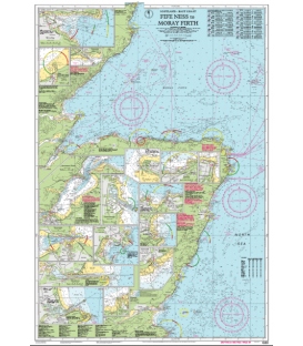
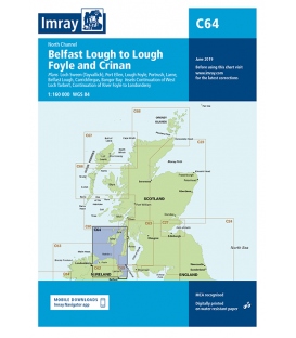
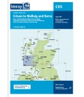
Imray Chart C64 North Channel

Scale: 160000
Paper Size: 36.0" x 48.0"
Actual Chart Size: 31.0" x 44.0"
Edition Date: 2016-04-01
Online Chart Viewer
More info
Imray Chart C64 North Channel
Belfast Lough to Lough Foyle and Crinan
Scale: 1:160,000 WGS 84
Plans included:
Loch Sween (Tayvallich) (1:25 000)
Continuation of West Loch Tarbert (1:65 000)
Port Ellen (1:25 000)
Lough Foyle (1:90 000)
Portrush (1:20 000)
Larne (1:18 500)
Belfast Lough (1:110 000)
Carrickfergus (1:15 000)
Bangor Bay (1:17 500)
Continuation of River Foyle to Londonderry (1:60 000)
On this edition the latest depth surveys have been applied along with general updating throughout.