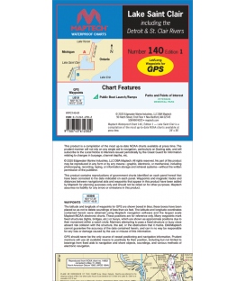
Maptech - Lake St. Clair Waterproof Chart, 1st Edition 2020
Includes Detroit and St. Clair Rivers. Features GPS waypoints, public boat launches, boat ramps and points of interest. 24" x 36", scales 1:75,000 and 1:50,000 with insets.
Maryland Nautical uses cookies to enhance your e-commerce experience. To view more information about our cookie use, click here to view our Privacy Policy.