- Home
- >
- Nautical Charts
- >
- Waterproof Charts
- >
- Richardson's Maptech
- >
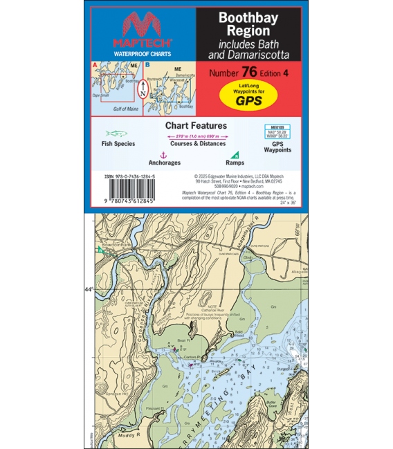
- Maptech Waterproof Chart WPC076, Boothbay Region, 4th Edition, 2025
Categories
- CLEARANCE
- New Editions
- Nautical Charts
- Nautical Books
- E-Readers & E-Books
- Occupational Safety & Health Administration (OSHA)
- Destinations
- Code of Federal Regulations (CFR)
- USCG Exam Study Materials
- International Maritime Org. (IMO)
- Sealite Aids to Marine Navigation
- Flags
- Digital Charts
- Nautical Software
- Marine Supplies
- Navigation Equipment
- Intracoastal Waterway
- Ocean Cruising
- Great Circle Route
- Gift Shop


Sign up for our Newsletter
RM-C076
New product
More info
Maptech Waterproof Chart WPC076, Boothbay Region, 4th Edition, 2025
Great coverage of Boothbay and surrounding waters from Cape Small and the Kennebec River east to the Damariscotta River. Featuring waypoints, courses and distances, ramp locations, and fish species information. 24" x 36", scale 1:40,000 with insets.
Reviews
30 other products in the same category:
- About Us
- Our Services
- Ordering & Shipping
- Resource Links
- Blog
- CLEARANCE
- New Editions
- Nautical Charts
- Nautical Books
- E-Readers & E-Books
- Occupational Safety & Health Administration (OSHA)
- Destinations
- Code of Federal Regulations (CFR)
- USCG Exam Study Materials
- International Maritime Org. (IMO)
- Sealite Aids to Marine Navigation
- Flags
- Digital Charts
- Nautical Software
- Marine Supplies
- Navigation Equipment
- Intracoastal Waterway
- Ocean Cruising
- Great Circle Route
- Gift Shop

