Sign up for our Newsletter


Maptech Waterproof Chart WPC084, Marblehead to Cape Ann, 3rd Edition, 2016
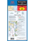
Detailed coverage from Marblehead, Salem and Beverly to Gloucester, Cape Ann, and Essex. Featuring GPS Waypoints, courses and distances, ramp locations, state parks, and fishing areas. 24" x 36", scales 1:25,000 and 1:26,666 with insets.