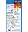
Point Conception to Point Dume, Ed. 1, THE chart for crossing to the Channel Islands! Includes charts of Santa Barbara, Ventura, and Channel Islands Harbor. Contains pre-plotted GPS waypoints, courses and marinas. 24Ó x 36Ó Approximate scales 1:232,188 and 1:58,824 with insets
Maryland Nautical uses cookies to enhance your e-commerce experience. To view more information about our cookie use, click here to view our Privacy Policy.