Sign up for our Newsletter


More info
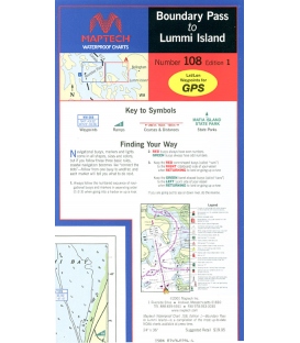
Boundary Pass to Lummi Island, Ed. 1, Includes North and South Pender islands, Saturna Island, and Sucia Island. Featuring waypoints for major buoys and channels, pre-plotted courses and distances, public boat launch locations, and state park information. Approximate Scale 1:30,000.