Sign up for our Newsletter


More info
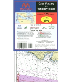
Cape Flattery to Whidbey Island, Strait of Juan De Fuca, with detail of Dungeness Bay to Port Townsend. Featuring waypoints for major buoys and channels, pre-plotted courses, public boat launch locations, and state park information. Approximate Scale 106,600 and 1:53,300 with insets