Sign up for our Newsletter


More info
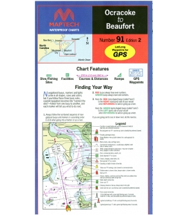
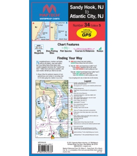
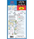
Maptech Waterproof Chart 34, Sandy Hook, NJ to Atlantic City, NJ, 5th Edition, 2021
Navesink and Shrewsbury rivers, Barnegat Bay, and Beach Haven, Little Egg, Brigantine, and Absecon inlets. Featuring GPS waypoints, dive and fishing sites, fish species, courses and distances, and ramps. 24" x 36", scale 1:52,000.