Sign up for our Newsletter


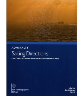
Admiralty Sailing Directions NP69A East Coast Central America And Gulf Of Mexico Pilot, 9th Edition 2020

ISBN: 978-0-70-774-5817
*** e-NP shopper, please read below carefully
Click here to read the User Guide
| Admiralty Chart Catalogue | Admiralty Publications | |
 |
 |
Admiralty Sailing Directions NP69A East Coast Central America And Gulf Of Mexico Pilot, 9th Edition 2020
Western Caribbean Sea and Gulf of Mexico from Punta Terraba to Cape Sable including Yucatan Channel
e-NP:
Admiralty e-NPs are not downloaded direct from this site. The e-NP Program will be mailed to you from Maryland Nautical Sales and a User Name and Password will be emailed direct from the United Kingdom Hydrographic Office. Once the e-NP Program is received and activated please notify Maryland Nautical Sales. Your e-NP permits will then be created and emailed.
If it is preferred to download the e-NP program from the Admiralty ftp site please download from the below link.
Download ADMIRALTY e-Nautical Publications
Admiralty digital products are available via our public FTP download site using the following settings:
URL: FTP://ukho.gov.uk
Username: ukhopublic
Password: Public12345
Note: The username and password details are case sensitive.
| CONTENTS | ||
| Pages | ||
| Record of updates | ii | |
| Preface | iii | |
| Reporting new dangers to navigation | iv | |
| Feedback | iv | |
| Contents | v | |
| Abbreviations | vii | |
| Glossary | ic | |
| Chapter Index Diagram | xii | |
|
CHAPTER 1
|
||
| Navigation and regulations | ||
| Limits of the book (1.1) | 1 | |
| Country information (1.2) | 1 | |
| Navigational dangers and hazards (1.25) | 3 | |
| Traffic and operations (1.31) | 4 | |
| Charts (1.40) | 5 | |
| Aids to navigation (1.47) | 5 | |
| Pilotage (1.52) | 6 | |
| Radio facilities (1.57) | 6 | |
| Regulations International (1.64) | 7 | |
| Signals (1.86) | 9 | |
| Distress and rescue (1.90) | 10 | |
| Natural conditions | ||
| Maritime topography (1.96) | 12 | |
| Currents, tidal streams and flow (1.99) | 12 | |
| Sea level and tides (1.108) | 17 | |
| Sea and swell (1.109) | 17 | |
| Sea water characteristics (1.113) | 22 | |
| Climate and weather (1.114) | 22 | |
| Climate information (1.148) | 43 | |
|
CHAPTER 2
|
||
| Through routes | 63 | |
|
CHAPTER 3
|
||
| Punta Terraba to Cabo Camaron | 71 | |
|
CHAPTER 4
|
||
| Cabo Cameron to Punta Gorda | 83 | |
|
CHAPTER 5
|
||
| Punta Gorda to Cabo Catoche | 99 | |
|
CHAPTER 6
|
||
| Cabo Catoche to the mouth of Rio Grande | 115 | |
|
CHAPTER 7
|
||
| Rio Grande to Calcasieu Pass | 147 | |
|
CHAPTER 8
|
||
| Calcasieu Pass to the South-east approaches to Pascagoula | 189 | |
|
CHAPTER 9
|
||
| Cape Sable to Cape San Blas | 211 | |
|
CHAPTER 10
|
||
| Cape San Blas to Horn Island Pass | 233 | |
|
APPENDICES AND INDEX
|
||
| Appendix I | ─ Vessel Bridge-to-Bridge Radio Telephone | 252 |
| Appendix II | ─ United States - Ports and Waterways safety - General | 253 |
| Appendix III | ─ Navigation Rules for United States Inland Waters | 260 |
| Appendix IV | ─ United States Navigation Safety Regulations | 272 |
| Appendix V | ─ United States - Regulated Navigation Areas - Extracts | 279 |
| Appendix VI | ─ United States - Danger Zones and Restricted Area Regulations | 284 |
| Appendix VII | ─ United States - Oil and Harzarous Material Transfer Operations | 289 |
| Appendix VIII | ─ United States - Vessel Traffic Management Regulations | 293 |
| Appendix IX | ─ United States - Navigation Regulations | 297 |
| Appendix X | ─ United States - Inland Waterways Navigation Regulations | 298 |
| Appendix XI | ─ United States - Deepwater ports: Operations | 299 |
| Appendix XII | ─ United States - Shipping Safety Fairways | 302 |
| Appendix XIII | ─ United States - National Marine Senctuary Program Regulations | 304 |
|
DISTANCE TABLE
|
||
| Table of Distance - Caribbean Sea and Gulf of Mexico | 308 | |
|
INDEX
|
||
| Index | 309 | |
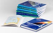
Often referred to as Pilots, Sailing Directions are designed for use by the merchant mariner on all classes of ocean-going vessels with essential information on all aspects of navigation. Sailing Directions are complementary to Admiralty Standard Nautical Charts and provide worldwide coverage in 74 volumes. Each publication contains quality colour photography and views, as well as information on navigational hazards, buoyage, meteorological data, details of pilotage, regulations, port facilities and guides to major port entry. New Editions of Admiralty Sailing Directions are published on a regular basis. Navigationally significant information for these publications is issued via the Admiralty Notices to Mariners weekly bulletin (Section IV).
NP69A
Publication Details
- Number NP69A
- Title East Coasts of Central America and Gulf of Mexico Pilot
- Sub Title n/a
- Type Sailing Directions (Pilots)
- SubType
- Edition No 9
- Pub Year 2020
Publication Supplement Details
- Sup. Number NP69AS
- Sup. Title
- Sup. Year
- Edition No
| dio |