

Sign up for our Newsletter
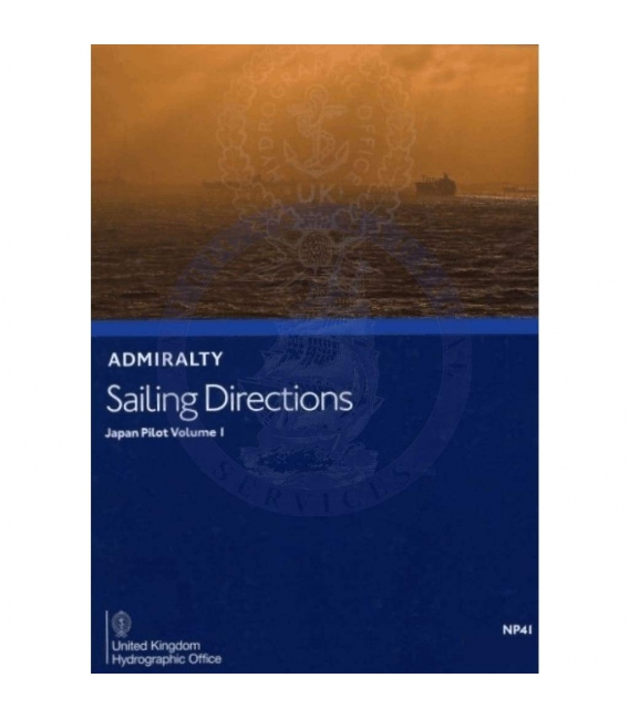
Admiralty Sailing Directions NP41 Japan Pilot, Vol. I, 13th (2021) Edition
ISBN: 978-0-70-774-5121 (9780707745121)
*** e-NP shopper, please read below carefully
Click here to read the User Guide
| Admiralty Chart Catalogue | Admiralty Publications | |
 |
 |
NP41 Admiralty Sailing Directions Japan Pilot Volume 1 Honshu (except its southern coasts), Hokkaido, The southern coast of Ostrov Sakhalin Kuril'skiye Ostrova, 13th (2021) Edition
e-NP:
Admiralty e-NPs are not downloaded direct from this site. The e-NP Program will be mailed to you from Maryland Nautical Sales and a User Name and Password will be emailed direct from the United Kingdom Hydrographic Office. Once the e-NP Program is received and activated please notify Maryland Nautical Sales. Your e-NP permits will then be created and emailed.
If it is preferred to download the e-NP program from the Admiralty ftp site please download from the below link.
Download ADMIRALTY e-Nautical Publications
Admiralty digital products are available via our public FTP download site using the following settings:
URL: FTP://ukho.gov.uk
Username: ukhopublic
Password: Public12345
Note: The username and password details are case sensitive.
Often referred to as Pilots, Sailing Directions are designed for use by the merchant mariner on all classes of ocean-going vessels with essential information on all aspects of navigation. Sailing Directions are complementary to Admiralty Standard Nautical Charts and provide worldwide coverage in 74 volumes.
Each publication contains quality colour photography and views, as well as information on navigational hazards, buoyage, meteorological data, details of pilotage, regulations, port facilities and guides to major port entry.
New Editions of Admiralty Sailing Directions are published on a regular basis. Navigationally significant information for these publications is issued via the Admiralty Notices to Mariners weekly bulletin (Section IV).
| CONTENTS | ||
| Pages | ||
| Directions for updating | ii | |
| Record of updates | ii | |
| Contents | iii | |
| Preface | v | |
| Purpose of Sailing Directions | vi | |
| Reporting new dangers to navigation | vi | |
| Feedback | vi | |
| UKHO contact details | vii | |
| How to obtain Admiralty Charts and Publications | vii | |
| Related Admiralty Publications and their contents | viii | |
| General Information | x | |
| Abbreviations | xii | |
| Glossary | xiv | |
| Index Chartlet | xviii | |
| CHATPER 1 | ||
| Navigation and regulations | ||
| Limits of the book (1.1) | 1 | |
| Navigational dangers and hazards (1.2) | 1 | |
| Traffic and operations (1.13) | 3 | |
| Charts (1.28) | 4 | |
| Aids to navigation (1.36) | 5 | |
| Pilotage (1.43) | 6 | |
| Radio facilities (1.49) | 7 | |
| Regulations (1.59) | 8 | |
| Signals (1.85) | 13 | |
| Distress and rescue (1.98) | 15 | |
| Countries and ports | ||
| Japan (1.105) | 17 | |
| Russian Federation (1.112) | 17 | |
| Natural conditions | ||
| Maritime topography (1.116) | 19 | |
| Local magnetic anomalies (1.124) | 19 | |
| Currents (1.125) | 19 | |
| Tides (1.132) | 22 | |
| Sea and swell (1.135) | 23 | |
| Sea water Characteristics (1.138) | 23 | |
| Ice conditions (1.139) | 23 | |
| Climate and weather (1.147) | 32 | |
| Climate information (1.170) | 53 | |
| CHAPTER 2 | ||
| Through Routes | 77 | |
| CHAPTER 3 | ||
| Honshu North-West Coast─Kanda Misaki to Kyoga Misaki | 83 | |
| CHAPTER 4 | ||
| Honshu North-West Coast─Kyoga Misaki to Rokko Saki | 115 | |
| CHAPTER 5 | ||
| Honshu North-West Coast─Rokka Saki to Tappoi Saki | 139 | |
| CHAPTER 6 | ||
| Tsugaru Kaikyo | 173 | |
| CHAPTER 7 | ||
| Honshu East Coast─Taito Saki to Shiriya Saki | 189 | |
| CHAPTER 8 | ||
| Hokkaido─West Coast with the offshore islands, and La Perouse Strait | 235 | |
| CHAPTER 9 | ||
| Hokkaido─South Coast Esan Misaki to Nosappu Misaki | 265 | |
| CHAPTER 10 | ||
| Hokkaido─East and North Coasts from Nosappu Misaki to Soya Misaki | 285 | |
| CHAPTER 11 | ||
| Kuril'sklye Ostrova─Nosappu Misaki to Proliv Bussol' | 299 | |
| CHAPTER 12 | ||
| Kuril'sklye Ostrova─Proliv Bussol' to Poluostrov Kamchatka | 317 | |
| APPENDICES | ||
| Appendix I ─ Russian Federation-Russian Related Areas | 334 | |
| Appendix II ─ Separation Zones and Recommended Tracks | 339 | |
| INDEX | ||
| Index | 344 | |
Often referred to as Pilots, Sailing Directions are designed for use by the merchant mariner on all classes of ocean-going vessels with essential information on all aspects of navigation. Sailing Directions are complementary to Admiralty Standard Nautical Charts and provide worldwide coverage in 74 volumes. Each publication contains quality colour photography and views, as well as information on navigational hazards, buoyage, meteorological data, details of pilotage, regulations, port facilities and guides to major port entry. New Editions of Admiralty Sailing Directions are published on a regular basis. Navigationally significant information for these publications is issued via the Admiralty Notices to Mariners weekly bulletin (Section IV).
NP41
Publication Details
- Number NP41
- Title Japan Pilot Vol 1
- Sub Title n/a
- Type Sailing Directions (Pilots)
- SubType
- Edition No. 13TH
- Pub Year 2021

