

Sign up for our Newsletter
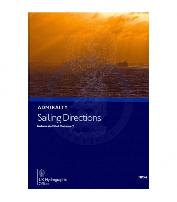
Admiralty Sailing Directions NP34 Indonesia Pilot, Vol. II, 10th Edition 2022
ISBN: 978-0-70-774-7521
*** e-NP shopper, please read below carefully
Admiralty Sailing Directions NP34 Indonesia Pilot, Vol. II, 10th Edition 2022
South Coast of Jawa, North Coast of Jawa eastwards from Tanjung Bendoh including Pulau Madura and Bali, Nusa Tenggara eastwards to Pulau-pulau Alor including Pulau Sumba, South Coast of Kalimantan as far north as the border with Sabah Sulawesi and the west part of Pulau-pulau Sula Christmas Island.
e-NP:
Admiralty e-NPs are not downloaded direct from this site. The e-NP Program will be mailed to you from Maryland Nautical Sales and a User Name and Password will be emailed direct from the United Kingdom Hydrographic Office. Once the e-NP Program is received and activated please notify Maryland Nautical Sales. Your e-NP permits will then be created and emailed.
If it is preferred to download the e-NP program from the Admiralty ftp site please download from the below link.
Download ADMIRALTY e-Nautical Publications
Admiralty digital products are available via our public FTP download site using the following settings:
URL: FTP://ukho.gov.uk
Username: ukhopublic
Password: Public12345
Note: The username and password details are case sensitive.
| CONTENTS: | ||
| Pages | ||
| Record of updates | ii | |
| Preface | iii | |
| Reporting new dangers to navigation | iv | |
| Feedback | iv | |
| Contents | v | |
| Abbreviations | vii | |
| Glossary | ix | |
| Chapter Index Diagram | xiv, xv, and xvi | |
|
CHAPTER 1
|
||
| Navigation and regulations | ||
| Limits of the book (1.1) | 1 | |
| Country Information (1.3) | 2 | |
| Navigational dangers and hazards (1.7) | 2 | |
| Traffic and operations (1.16) | 4 | |
| Charts (1.28) | 5 | |
| Aids to navigation (1.37) | 6 | |
| Pilotage (1.40) | 6 | |
| Radio facilities (1.43) | 7 | |
| Regulations (1.49) | 7 | |
| Signals (1.60) | 9 | |
| Distress and rescue (1.64) | 10 | |
| Natural conditions | ||
| Maritime topography (1.67) | 11 | |
| Magnetic variation and local anomalies (1.73) | 12 | |
| Currents, tidal streams and flow (1.74) | 12 | |
| Sea level and tides (1.84) | 18 | |
| Sea and swell (1.86) | 18 | |
| Sea water characteristics (1.89) | 18 | |
| Climate and weather (1.94) | 27 | |
| Climate information (1.118) | 42 | |
|
CHAPTER 2
|
||
| Through Routes ─ Jawa Sea | 65 | |
|
CHAPTER 3
|
||
| South Coast of Jawa and Christmas Island | 69 | |
|
CHAPTER 4
|
||
| North Coast of Jawa ─ Tanjung Bendoh to Tanjung Sedano, Selat Surabaya, the Port of Tanjungperak, Selat Madura and Selat Sapudi, Pulau Bawean and Pulau-pulau Kangean | 83 | |
|
CHAPTER 5
|
||
| Selat Bali, Selat Lombok and Selat Alas including the East Coast of Jawa, Pulau Bali, Pulau Lombok and the West Coast of Pulau Sumbawa | 111 | |
|
CHAPTER 6
|
||
| South and North Coasts of Pulau Sumbawa, Pulau-pulau Tengah and Pulau-pulau Sabalana, straits between Pulau Sumbawa and the West Coast of Flores | 137 | |
|
CHAPTER 7
|
||
| Pulau Sumba, Selat Sumba, South and North Coasts of Flores | 167 | |
|
CHAPTER 8
|
||
| East Coast of Flores, Selat Flores, Pulau-pulau Solor, Pulau-pulau Alor | 191 | |
|
CHAPTER 9
|
||
| South Coast of Kalimantan ─ Tanjung Puting to Pulau Laut including the Port of Benjarmasin | 215 | |
|
CHAPTER 10
|
||
| Westen side of Selat Makassar including the East Coast of Kalimantan, Pulau Laut, Pulau-pulau Lima and Pulau-pulau Balabalagan | 229 | |
|
CHAPTER 11
|
||
| Eastern side of Selat Makassar including the West Coast of Sulawesi and the outlying islands and danger in the southern part of the strait | 261 | |
|
CHAPTER 12
|
||
| East Coast of Kalimantan ─ Tanjung Mangkalihat to Ujung Batu | 289 | |
|
CHAPTER 13
|
||
| South Coats of South and South-east Sulawesi, Teluk Bone, Selat Selayar, Selat Tioro, and Selat Buton, together with Alur Pelayaran Buton and outlying islands and danger | 311 | |
|
CHAPTER 14
|
||
| East Coats of South-east and Central Sulawesi including the off-lying islands of Pulau-pulau Banggai and the Western Part of Pulau-pulau Sula | 347 | |
|
CHAPTER 15
|
||
| Teluk Tomini and the South-east Coast of North SUlawesi | 371 | |
|
CHAPTER 16
|
||
| North Coast of Sulawesi, including Selat Bangka | 397 | |
|
APPENDIXES AND INDEX
|
||
| Appendix I Formar Mined Areas | 415 | |
| Appendix II Archipelagic Sea Lanes | 421 | |
|
DISTANCES TABLE
|
||
| Distance Table - Eastern Archipelago | 423 | |
|
INDEX
|
||
| Index | 424 | |

