- Home
- >
- Nautical Charts
- >
- Chart Books
- >
- Chart Books Richardson's Maptech
- >
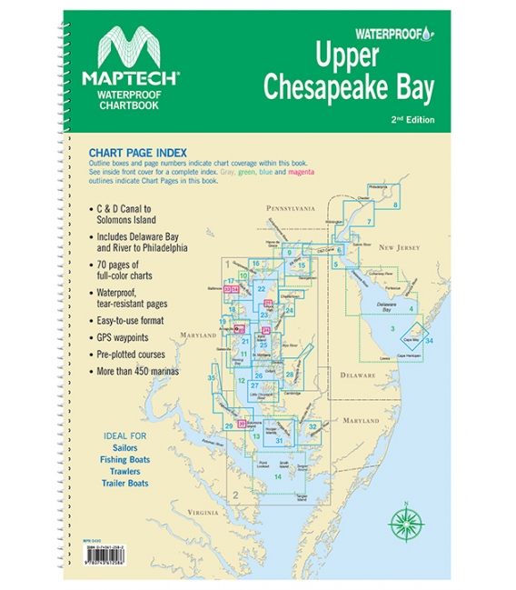
- Upper Chesapeake Bay, 2nd Edition 2023
Categories
- CLEARANCE
- New Editions
- Nautical Charts
- Nautical Books
- E-Readers & E-Books
- Occupational Safety & Health Administration (OSHA)
- Destinations
- Code of Federal Regulations (CFR)
- USCG Exam Study Materials
- International Maritime Org. (IMO)
- Sealite Aids to Marine Navigation
- Flags
- Digital Charts
- Nautical Software
- Marine Supplies
- Navigation Equipment
- Intracoastal Waterway
- Ocean Cruising
- Great Circle Route
- Gift Shop


Sign up for our Newsletter
RMCB-CB-U
New product
ISBN: 978-0-743611-72-5
More info
Upper Chesapeake Bay, 2nd Edition 2023
Covers C&D Canal to Solomons Island and includes Delaware Bay and River to Philadelphia. Offers full-color charts on waterproof, tear-resistant pages. Easy-to-use format includes GPS waypoints, pre-plotted courses and more than 450 marinas. 70 chart pages.
Reviews
30 other products in the same category:
Customers who bought this product also bought:
- About Us
- Our Services
- Ordering & Shipping
- Resource Links
- Blog
- CLEARANCE
- New Editions
- Nautical Charts
- Nautical Books
- E-Readers & E-Books
- Occupational Safety & Health Administration (OSHA)
- Destinations
- Code of Federal Regulations (CFR)
- USCG Exam Study Materials
- International Maritime Org. (IMO)
- Sealite Aids to Marine Navigation
- Flags
- Digital Charts
- Nautical Software
- Marine Supplies
- Navigation Equipment
- Intracoastal Waterway
- Ocean Cruising
- Great Circle Route
- Gift Shop
Accept
Maryland Nautical uses cookies to enhance your e-commerce experience. To view more information about our cookie use, click here to view our Privacy Policy.

