- Home
- >
- Nautical Charts
- >
- Chart Books
- >
- Chart Books Richardson's Maptech
- >
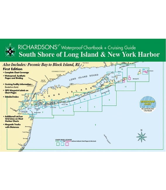
- South Shore of Long Island, 1st Ed. 2000
Categories
- CLEARANCE
- New Editions
- Nautical Charts
- Nautical Books
- E-Readers & E-Books
- Occupational Safety & Health Administration (OSHA)
- Destinations
- Code of Federal Regulations (CFR)
- USCG Exam Study Materials
- International Maritime Org. (IMO)
- Sealite Aids to Marine Navigation
- Flags
- Digital Charts
- Nautical Software
- Marine Supplies
- Navigation Equipment
- Intracoastal Waterway
- Ocean Cruising
- Great Circle Route
- Gift Shop


Sign up for our Newsletter
RMCB-SSLI-NY
New product
*** Discontinued, replaced by the below:
South Shore Long Island (Raritan Bay to Montauk) (RMCB-SSLI-RB-M) and/or
Hudson River & New York Harbor (RMCB-HR/NY-WP)
More info
South Shore of Long Island, 1st Edition Also Includes: New York Harbor and Peconic Bay to Block Island, RI - 12 x 18" Spiral-bound Chartbook - Complete Chart Coverage - Waterproof, Synthetic Pages and Binding - Cruising Facility Information (located on charts) - GPS Waypoint Labels on Chart Pages - Detailed Index - Additional Lat/Lon Grid Lines on Most Harbor Charts ISBN:
Reviews
30 other products in the same category:
- About Us
- Our Services
- Ordering & Shipping
- Resource Links
- Blog
- CLEARANCE
- New Editions
- Nautical Charts
- Nautical Books
- E-Readers & E-Books
- Occupational Safety & Health Administration (OSHA)
- Destinations
- Code of Federal Regulations (CFR)
- USCG Exam Study Materials
- International Maritime Org. (IMO)
- Sealite Aids to Marine Navigation
- Flags
- Digital Charts
- Nautical Software
- Marine Supplies
- Navigation Equipment
- Intracoastal Waterway
- Ocean Cruising
- Great Circle Route
- Gift Shop

