

Sign up for our Newsletter
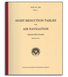
Pub 249, Volume 1: Sight Reduction for Air Navigation Selected Stars (Epoch 2025)
DESCRIPTION OF THE TABLES
These tables, designated as Volume 1 of the three-volume series of Pub. No. 249, Sight Reduction Tables for Air Navigation, contain values of the altitude (to the nearest minute) and the true azimuth (to the nearest degree) of seven selected stars for the complete ranges of latitude and hour angle of Aries. The arrangement provides, for any position and time, the best selection of seven of the stars available for observation and, for these seven stars, data for presetting before observation and for accurate reduction of the sights after observation.
Although Pub. No. 249 was designed for air navigation, it is also used extensively for marine navigation. The main differences in the use of Pub. No. 249 for marine navigation are highlighted at the end of this introduction. Volume 1 may be used without reference to an almanac such as The Air Almanac or The Nautical Almanac. The tables in this volume may be used with a clock, or other device, giving sidereal time.
USE OF THE TABLES
The tables are intended for use for two distinct operations—the planning of observations, and their reduction. It is important that full use should be made of the tables for the planning of observations. Planning of observations. Since only seven stars are given it is essential to refer to the tables before observation, in order to ensure that data will be available for the reduction of the observations.
This is done by estimating latitude and LHA ϒ for the proposed time of observation, from a knowledge of the DR position and GHA ϒ from Table 4 or an appropriate almanac, such as The Air Almanac or The Nautical Almanac. On reference to the tables this information gives immediately the seven stars available, together with their approximate altitudes and azimuths. From these seven stars, the observer can select those which best suit his particular purpose and the prevailing conditions; the approximate altitudes and azimuths make identification easy, and enable the sextant to be preset to the approximate altitude.
These tables were designed for air navigation where weight and space are at a premium, however, they are very popular with sailors too due to the fact that Vol. 1 offers a speedier way to compute stars. The way the 6 volumes of 229 were combined into this 3 volume set is this: volumes 2 & 3 cover all latitudes, but work only for declinations from 0° to 29° north or south. This covers the sun, moon, planets, and only those stars whose declinations fall into this range. Volume 1 contains some stars (whose declinations may be more than 29°) that are pre-selected for optimum viewing and direction. This volume is applicable for an 8 year period, centered on its Epoch date. The only drawback to this arrangement, is that it is possible that a star may be observed that is not one of the pre-selected ones, and whose declination is more than 29° north or south. This star, if observed on some unlikely occasion, say through a break in the overcast, could not be computed using the 249 tables. Nevertheless this remains the most popular tabular system in use.
Because of the high price and spotty availability of the Government editions, we have reprinted these as Commercial Editions from official Government electronic files or software. They are economical, and sized at 90% of the originals. They have soft instead of hard covers and their smaller size of 8.5 x 11 inches is easier to carry and store. SW 2.1 lbs


