Sign up for our Newsletter
")
")

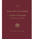
Pub. No. 229 Vol. 3: Sight Reduction Tables For Marine Navigation Latitudes 30°–45°, Inclusive
This six-volume series of Sight Reduction Tables for Marine Navigation is designed to facilitate the practice of celestial navigation at sea by the Marcq Saint Hilaire or intercept method.
The tabular data are the solutions of the navigational triangle of which two sides and the included angle are known and it is necessary to find the values of the third side and adjacent angle.
The tables, intended for use with The Nautical Almanac, are designed for precise interpolation of altitude for declination by means of interpolation tables which facilitate linear interpolation and provide additionally for the effect of second differences when required.
The concept, design, development, and preparation of these tables are the results of the collaborative efforts and joint accomplishments of the National Imagery and Mapping Agency, the U.S. Naval Observatory, and Her Majesty’s Nautical Almanac Office, Royal Greenwich Observatory. The tabular material in identical format has been published in the United Kingdom by the Hydrographic Department, Ministry of Defence (Navy), as N.P. 401.
This reprint was compiled on a Hewlett Packard K420 server with an HP C180 client workstation, and was composed in its entirety as a digital document.
| PREFACE | III | |
| INTRODUCTION | V | |
| A. DESCRIPTION OF TABLES | ||
| 1. Purpose and Scope. . . . . . . . . . . . . . . . . . . . . . . . . . . . . . . . . . . . . . . . | V | |
| 2. Arrangement. . . . . . . . . . . . . . . . . . . . . . . . . . . . . . . . . . . . . . . . . . . . . | V | |
| B. INTERPOLATION | ||
| 1. Requirements . . . . . . . . . . . . . . . . . . . . . . . . . . . . . . . . . . . . . . . . . . . . | X | |
| 2. First and Second Differences . . . . . . . . . . . . . . . . . . . . . . . . . . . . . . . . | X | |
| 3. Linear Interpolation . . . . . . . . . . . . . . . . . . . . . . . . . . . . . . . . . . . . . . . | X | |
| 4. The Interpolation Table . . . . . . . . . . . . . . . . . . . . . . . . . . . . . . . . . . . . . | XI | |
| 5. Interpolation when Second Differences are Required . . . . . . . . . . . . . . . | XIII | |
| C. SPECIAL TECHNIQUES | ||
| 1. Adjustment of Straight Line of Position. . . . . . . . . . . . . . . . . . . . . . . . . . | XV | |
| 2. Interpolation for Latitude and Local Hour Angle. . . . . . . . . . . . . . . . . . . | XVII | |
| 3. Interpolation near the Horizon. . . . . . . . . . . . . . . . . . . . . . . . . . . . . . . . | XVII | |
| 4. Negative Altitudes. . . . . . . . . . . . . . . . . . . . . . . . . . . . . . . . . . . . . . . . . | XVIII | |
| 5. Interpolation near the Zenith. . . . . . . . . . . . . . . . . . . . . . . . . . . . . . . . . . | XVIII | |
| D. OTHER APPLICATIONS | ||
| 1. Star Identification.. . . . . . . . . . . . . . . . . . . . . . . . . . . . . . . . . . . . . . . . . | XIX | |
| 2. Great-Circle Sailing. . . . . . . . . . . . . . . . . . . . . . . . . . . . . . . . . . . . . . . . | XX | |
| 3. Points along Great Circle. . . . . . . . . . . . . . . . . . . . . . . . . . . . . . . . . . . . | XXIII | |
| 4. General Spherical Triangle Solutions. . . . . . . . . . . . . . . . . . . . . . . . . . . | XXIII | |
| 5. Compass Error. . . . . . . . . . . . . . . . . . . . . . . . . . . . . . . . . . . . . . . . . . . | XXIV | |
| E. BACKGROUND | ||
| 1. Accuracy of Tables.. . . . . . . . . . . . . . . . . . . . . . . . . . . . . . . . . . . . . . . | XXV | |
| 2. Computation Formulas. . . . . . . . . . . . . . . . . . . . . . . . . . . . . . . . . . . . . | XXV | |
| F. GLOSSARY. . . . . . . . . . . . . . . . . . . . . . . . . . . . . . . . . . . . . . . . . . . . | XXVI | |
| G. EXAMPLE SIGHT REDUCTIONS.. . . . . . . . . . . . . . . . . . . . . . . . . . | XXIX | |
| TABLE OF OFFSETS. . . . . . . . . . . . . . . . . . . . . . . . . . . . . . . . . . . . . . . . | XVI | |
| SIGHT REDUCTION TABLES | ||
| Latitudes 30° to 37° . . . . . . . . . . . . . . . . . . . . . . . . . . . . . . . . . . . . . . . . . | 2-183 | |
| Latitudes 38° to 45° . . . . . . . . . . . . . . . . . . . . . . . . . . . . . . . . . . . . . . . . . | 184-365 | |
| INTERPOLATION TABLE | ||
| Declination Increment—0.0' to 31.9'. . . . . . . . . . . . . . . . . . . . . . . . . . . . . | Inside front cover | |
| Declination Increment—28.0' to 59.9'. . . . . . . . . . . . . . . . . . . . . . . . . . . . | Inside back cover | |