- Home
- >
- Nautical Books
- >
- By Publisher
- >
- Prostar Publications
- >
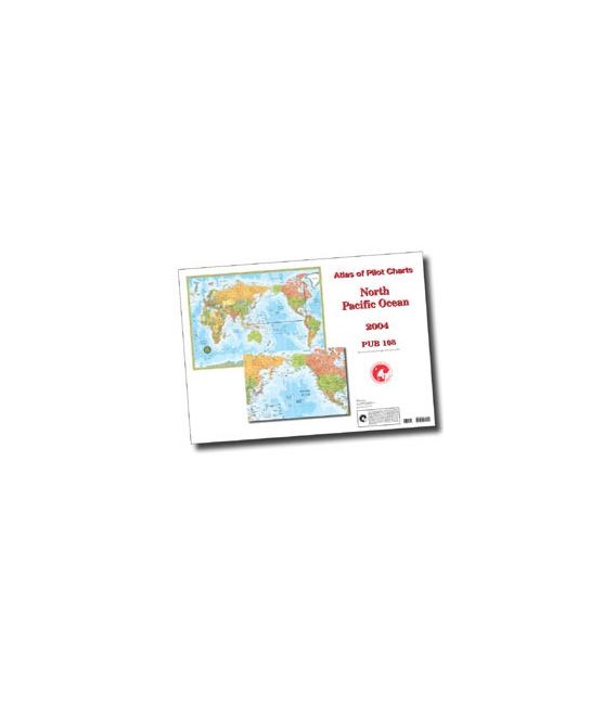
- Pub. 108 - Atlas of Pilot Charts North Pacific Ocean, 3rd Ed., 1994 (Revised & Corrected through NGA NM 01/2011)
Categories
- CLEARANCE
- New Editions
- Nautical Charts
- Nautical Books
- E-Readers & E-Books
- Occupational Safety & Health Administration (OSHA)
- Destinations
- Code of Federal Regulations (CFR)
- USCG Exam Study Materials
- International Maritime Org. (IMO)
- Sealite Aids to Marine Navigation
- Flags
- Digital Charts
- Nautical Software
- Marine Supplies
- Navigation Equipment
- Intracoastal Waterway
- Ocean Cruising
- Great Circle Route
- Gift Shop


Sign up for our Newsletter
Pub. 108 - Atlas of Pilot Charts North Pacific Ocean, 3rd Ed., 1994 (Revised & Corrected through NGA NM 01/2011)
PSP108
New product
PUB 108: Atlas of Pilot Charts: North Pacific Ocean, 3rd Ed., 1994 (Revised & Corrected through NGA NM 01/2011)
(3rd Edition). PUB 108 covers the North Pacific Ocean from the Bering Strait between Alaska and Russia down to the equator, including the eastern coasts of China and the Philippines and the western coast of North America. There is also information about drifting objects on the ocean. The chart is divided by each month of the year. 20-1/4" x 28". Pilot Charts depict averages in prevailing winds and currents, air and sea temperatures, wave heights, ice limits, visibility, barometric pressure, and weather conditions at different times of the year. The information used to compile these averages was obtained from oceanographic and meteorologic observations over many decades during the late 18th and 19th centuries. The Atlas of Pilot Charts set is comprised of five volumes, each covering a specific geographic region. Each volume is an atlas of twelve pilot charts, each depicting the observed conditions for a particular month of any given year. The charts are intended to aid the navigator in selecting the fastest and safest routes with regards to the expected weather and ocean conditions. The charts are not intended to be used for navigation. ISBN:
Reviews
30 other products in the same category:
Customers who bought this product also bought:
- About Us
- Our Services
- Ordering & Shipping
- Resource Links
- Blog
- CLEARANCE
- New Editions
- Nautical Charts
- Nautical Books
- E-Readers & E-Books
- Occupational Safety & Health Administration (OSHA)
- Destinations
- Code of Federal Regulations (CFR)
- USCG Exam Study Materials
- International Maritime Org. (IMO)
- Sealite Aids to Marine Navigation
- Flags
- Digital Charts
- Nautical Software
- Marine Supplies
- Navigation Equipment
- Intracoastal Waterway
- Ocean Cruising
- Great Circle Route
- Gift Shop
Maryland Nautical uses cookies to enhance your e-commerce experience. To view more information about our cookie use, click here to view our Privacy Policy.

