- Home
- >
- Nautical Books
- >
- By Publisher
- >
- Prostar Publications
- >
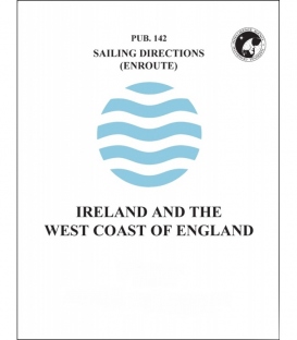
- Sailing Directions Pub. 142 Ireland and the West Coast of England, 17th Edition 2024
Categories
- CLEARANCE
- New Editions
- Nautical Charts
- Nautical Books
- E-Readers & E-Books
- Occupational Safety & Health Administration (OSHA)
- Destinations
- Code of Federal Regulations (CFR)
- USCG Exam Study Materials
- International Maritime Org. (IMO)
- Sealite Aids to Marine Navigation
- Flags
- Digital Charts
- Nautical Software
- Marine Supplies
- Navigation Equipment
- Intracoastal Waterway
- Ocean Cruising
- Great Circle Route
- Gift Shop


Sign up for our Newsletter
PSSD142-M
New product
Sailing Directions Pub. 142 Ireland and the West Coast of England, 17th Edition 2024
Preface
Pub. 142, Sailing Directions (Enroute) Ireland and the West Coast of England, Seventeenth Edition 2024, is issued for use in conjunction with Pub. 140, Sailing Directions (Planning Guide) North Atlantic Ocean and Adjacent Seas. 0.0 Companion volumes are Pubs. 141, 143, 145, 146, 147, and 148.
Explanatory Remarks
Sailing Directions are published by the National Geospatial- Intelligence Agency (NGA), under the authority of Department of Defense Directive 5105.40, dated 12 December 1988, and pursuant to the authority contained in U. S. Code Title 10, Sections 2791 and 2792 and Title 44, Section 1336. Sailing Directions, covering the harbors, coasts, and waters of the world, provide information that cannot be shown graphically on nautical charts and is not readily available elsewhere.
Sailing Directions (Enroute) include detailed coastal and port approach information which supplements the largest scale chart produced by the National Geospatial-Intelligence Agency. This publication is divided into geographic areas called “Sectors.”
Bearings.—Bearings are true, and are expressed in degrees from 000° (north) to 360°, measured clockwise. General bearings are expressed by initial letters of points of the compass (e.g. N, NNE, NE, etc.). Adjective and adverb endings have been discarded. Wherever precise bearings are intended degrees are used.
Charts.—Reference to charts made throughout this publication refer to both the paper chart and the Digital Nautical Chart (DNC).
Coastal Features.—It is assumed that the majority of ships have radar. Available coastal descriptions and views, useful for radar and visual
Reviews
30 other products in the same category:
Customers who bought this product also bought:
- About Us
- Our Services
- Ordering & Shipping
- Resource Links
- Blog
- CLEARANCE
- New Editions
- Nautical Charts
- Nautical Books
- E-Readers & E-Books
- Occupational Safety & Health Administration (OSHA)
- Destinations
- Code of Federal Regulations (CFR)
- USCG Exam Study Materials
- International Maritime Org. (IMO)
- Sealite Aids to Marine Navigation
- Flags
- Digital Charts
- Nautical Software
- Marine Supplies
- Navigation Equipment
- Intracoastal Waterway
- Ocean Cruising
- Great Circle Route
- Gift Shop
Maryland Nautical uses cookies to enhance your e-commerce experience. To view more information about our cookie use, click here to view our Privacy Policy.


