Sign up for our Newsletter


More info
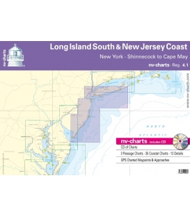
NV-Charts • Reg. 4.1 Long Island South & New Jersey Coast New York · Shinnecock to Cape May
• CD of Charts
• 3 Passage Charts - 35 Coastal Charts - 12 Details
• GPS Charted Waypoints & Approaches
Practical to use and accurate in the information and data published: This is the basic concept with which we have developed the nv-charts and the Harbor & Anchorage Pilot Books.
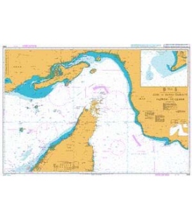
| • This Chart Region is based on NOAA data with a new layout, clear cartography and international chart standards |
| • Depths and heights are charted in feet |
| • Channel markers in red and green |
| • Unique color differences, blue for the 6 ft and 18 ft dephts, and green for exposed tidal areas |
| • Contour lines for 12 ft and 30ft depths |
| • Under water reefs are clearly marked with a light green color and the reef above water in darker green |
| • Variable shoals marked in grey-blue |
| • Lighthouses illustrate their light characteristics for better identification |
| • Seaworthy chart layout - perfect chart flow from one chart to the next |
| • Standardized chart scales - passage charts 1:340,000 – coastal charts 1:100,000 and 1:45,000 and detail charts 1:25,000 or less |
| • Waypoints with latitudes and longitudes for GPS input |
| • Arrow-symbols show buoyage direction |
| • Tide information on each chart |