Sign up for our Newsletter


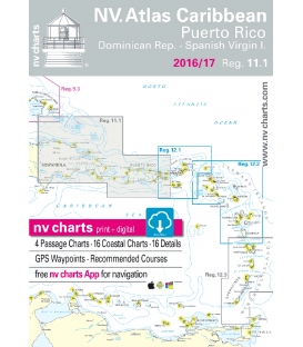
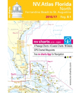
NV-Charts Region 8.1: Florida, North, Fernandia Beach to St. Augustine 2016/17
- • Digital charts download
- • Coastal Charts
- • Passage Charts
- • Details
- • GPS Charted Waypoints & Approaches
Practical to use and accurate in the information and data published: This is the basic concept with which we have developed the nv-charts.
- • this Chart Kit is based on NOAA data with a new layout, clear cartography and international chart standards
- • depths and heights are charted in feet
- • north up chart orientation
- • channel markers in red and green
- • unique color differences, blue for the 6 ft and 18 ft dephts, and green for exposed tidal areas
- • contour lines for 12 ft and 30ft depths
- • under water reefs are clearly marked with a light green color and the reef above water in darker green
- • variable shoals marked in grey-blue
- • lighthouses illustrate their light characteristics for better identification
- • seaworthy chart layout - perfect chart flow from one chart to the next
- • standardized chart scales - passage charts 1:340,000 – coastal charts 1:45,000 and detail charts 1:25,000 or less
- • waypoints with latitudes and longitudes for GPS input
- • recommended courses with distances
- • arrow-symbols show buoyage direction
- • tide information on each chart
Scale:
Passage Charts
C1 Morehead City to Daytona Beach 1: 1,300,000
C2 Cape Fear to Georgetown 1: 340,000
C3 Georgetown to Beaufort 1: 340,000
C4 Beaufort to Cumberland Island 1: 340,000
Coastal and Detail Charts
C5 Cape Fear River to Shallotte Inlet 1: 40,000
C6 Little River Inlet to North Myrtle Beach 1: 40,000
C7 Waccamaw River 1: 40,000
C8 Georgetown · Entrance 1: 40,000
C9 Cat Island to StM 438 1: 40,000
C10 StM 438 to Isle Of Palms 1: 40,000
C11 Isle Of Palms to Wadmalaw River · Charleston 1: 40,000
C12 Charleston 1: 30,000
C13 Wadmalaw River to South Edisto River 1: 40,000
C14 South Edisto River to Coosaw River 1: 40,000
C15 Coosaw River to Beaufort River 1: 40,000
C16 Coosaw River to Broad River 1: 40,000
C17 Broad & Chechessee River 1: 40,000
C18A Beaufort River 1: 40,000
C18B Broad Creek 1: 40,000
C19 Calibogue Sound to Savannah River 1: 40,000
C20 Savannah · Hutchinson I. 1: 20,000
C21 Skidaway to Ossabaw Island 1: 40,000
C22 St. Catherines to Sapelo Sound 1: 40,000
C23 Sapelo Sound 1: 40,000
C24 Doboy Sound 1: 40,000
C25 Hampton River 1: 40,000
C26 Brunswick · Jekyll Island 1: 40,000
C27 Cumberland Island · North 1: 40,000
C28 St. Marys Entrance 1: 40,000
C29A Murrells Inlet 1: 40,000
C29B North Edisto River Approach 1: 40,000
C30 Winyah Bay Entrance 1: 40,000
C31 Charleston · Entrance 1: 40/80,000
C32 Stono Inlet 1: 40,000
C33 St. Helena Sound 1: 40,000
C34 Port Royal Sound 1: 40,000
C35 Tybee Roads 1: 40,000
C36 Wassaw Sound 1: 40,000
C37 Wassaw & Ossabaw Sound 1: 80,000
C38 St. Catherines & Sapelo Sound 1: 80,000
C39 Jekyll & St. Simons I. · Brunswick 1: 40,000
C40 St. Simons Sound Entrance 1: 40,000
C41 St. Andrew Sound 1: 40,000