Sign up for our Newsletter


More info
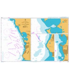
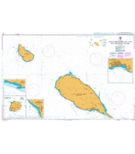
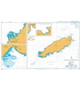
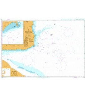
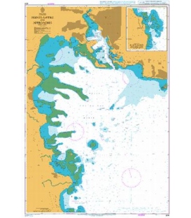
Chart 804
Main Chart Details
- Chart Title:Pointe-a-Pitre and Approaches
- Publication Date:03/01/1992
- Latest Edition date:01/02/2018
- Chart Size:643 x 942 (mm)
Chart Panel Details
- Panel NamePointe-A-Pitre and Approaches
- Area NameWest Indies, Guadeloupe
- Natural Scale15000
- North Limit16 15'.44N
- East Limit 61 29'.38W
- South Limit 16 06'.50N
- West Limit 61 35'.69W
- Panel Name Continuation to Sainte-Marie Anchorages
- Area Name West Indies, Guadeloupe
- Natural Scale 1500
- North Limit 16 06'.85N
- East Limit 61 32'.73W
- South Limit 16 05'.04N
- West Limit 61 34'.44W
Co-ordinates given are usually those of the four extremities of the chart. In many cases not all the area within will be fully charted*.Customers should check that the chart meets their requirements by viewing the chart image (where available).Mariners should always use the largest scale navigational chart available.
*Reasons may include
- Continuation of coverage of a small part outside the main area of chart coverage e.g a river.
- Inset plans and the chart title block and notes also take up space, therefore geographical information cannot be shown in this area.
- A need to refer to larger scale of chart, such waters are often "blued out" to avoid excessive maintenance work applying numerous NM corrections to an area of the small scale chart where the navigator will be using a larger scale chart.
- Coverage is better served from a different chart because of typical routeings.