Sign up for our Newsletter


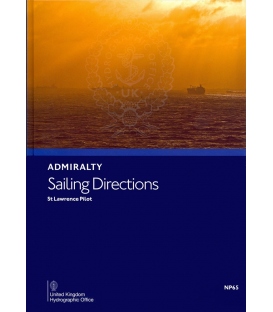
Admiralty Sailing Directions NP65 St Lawrence Pilot, 19th Edition 2020
ISBN: 978-0-70-774-5633 (9780707745633)
*** e-NP shopper, please read below carefully
Click here to read the User Guide
| Admiralty Chart Catalogue | Admiralty Publications | |
 |
 |
Admiralty Sailing Directions NP65 St Lawrence Pilot, 19th Edition 2020
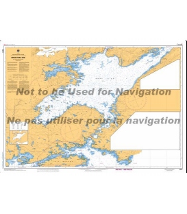
Gulf and River St Lawrence, East coast of Cape Breton Island Cabot Strait and Strait Canso
e-NP:
Admiralty e-NPs are not downloaded direct from this site. The e-NP Program will be mailed to you from Maryland Nautical Sales and a User Name and Password will be emailed direct from the United Kingdom Hydrographic Office. Once the e-NP Program is received and activated please notify Maryland Nautical Sales. Your e-NP permits will then be created and emailed.
If it is preferred to download the e-NP program from the Admiralty ftp site please download from the below link.
Download ADMIRALTY e-Nautical Publications
Admiralty digital products are available via our public FTP download site using the following settings:
URL: FTP://ukho.gov.uk
Username: ukhopublic
Password: Public12345
Note: The username and password details are case sensitive.
Often referred to as Pilots, Sailing Directions are designed for use by the merchant mariner on all classes of ocean-going vessels with essential information on all aspects of navigation. Sailing Directions are complementary to Admiralty Standard Nautical Charts and provide worldwide coverage in 74 volumes.
Each publication contains quality colour photography and views, as well as information on navigational hazards, buoyage, meteorological data, details of pilotage, regulations, port facilities and guides to major port entry.
New Editions of Admiralty Sailing Directions are published on a regular basis. Navigationally significant information for these publications is issued via the Admiralty Notices to Mariners weekly bulletin (Section IV).
| CONTENTS | ||
| Pages | ||
| Directions for updating | ii | |
| Record of updates | ii | |
| Contents | iii | |
| Preface | v | |
| Purpose of Sailing Directions | vi | |
| Reporting new dangers to navigation | vi | |
| Feedback | vi | |
| UKHO contact details | vii | |
| How to obtain Admiralty Charts and Publications | vii | |
| Related Admiralty Publications and their contents | viii | |
| General Information | x | |
| Abbreviations | xii | |
| Glossary | xiv | |
| Index charlet | xvi | |
|
CHAPTER 1
|
||
| Navigation and regulations | ||
| Limits of the book (1.1) | 1 | |
| Navigational dangers and hazards (1.2) | 1 | |
| Traffic amd operations (1.15) | 5 | |
| Charts (1.26) | 6 | |
| Aids to Navigation (1.35) | 7 | |
| Pilotage (1.50) | 8 | |
| Radio facilities (1.54) | 10 | |
| Regulations (1.67) | 11 | |
| Signals (1.86) | 13 | |
| Distress and rescue (1.93) | 14 | |
| Countries | ||
| Canada (1.104) | 16 | |
| Natural conditions | ||
| Maritime topography (1.118) | 18 | |
| Magnetic variation and local anomalies (1.120) | 18 | |
| Current, tidal streams and flow (1.121) | 18 | |
| Sea level and tides (1.128) | 20 | |
| Sea and swell (1.130) | 20 | |
| Sea water characteristics (1.133) | 20 | |
| Ice conditions (1.136) | 20 | |
| Climate and weather (1.146) | 29 | |
| Climate information (1.178) | 43 | |
|
CHAPTER 2
|
||
| Through routes from the Atlantic Ocean to the St Lawrence River | 65 | |
|
CHAPTER 3
|
||
| Gulf of St Lawrence, north shore ─ Strait of Belle ISle to Cap Whittle | 73 | |
|
CHAPTER 4
|
||
| Gulf of St Lawrence, north shore ─ Cap Whittle to Riviera Saint-Jean inclding north coast of Ile d'Anticosti | 87 | |
|
CHAPTER 5
|
||
| St Lawrence River, north shore ─ Riviere Saint-Jean to Reviere Saguenay | 101 | |
|
CHAPTER 6
|
||
| Gulf of St Lawrence ─ Cabot Strait and north coast of Cape Breton Island ─ Iles de la Madeleine ─ South coast of Ile d'Anticosti | 125 | |
|
CHAPTER 7
|
||
| St Lawrence River ─ south shore ─ Cap Gaspe to Ile Verte | 139 | |
|
CHAPTER 8
|
157 | |
| St Lawrence River ─ Ile Rouge to Cap Brule | ||
|
CHAPTER 9
|
||
| St Lawrence River ─ Cap Brule to Trois Rivieres | 173 | |
|
CHAPTER 10
|
||
| St Lawrence River ─ Trois Rivieres to Montreal and routes above Montreal | 191 | |
|
CHAPTER 11
|
||
| Cape Breton Island ─ east coast ─ Cape North to Michaud Point including Great Bras d'Or and Bras d'Or Lake | 211 | |
|
CHAPTER 12
|
||
| Chedabucto Bay ─ Lennox Passage ─ Strait of Canso and Saint Georges Bay | 231 | |
|
CHAPTER 13
|
||
| Cape Breton Island ─ north-west coast and Prince Edward Island ─ including Northumberland Starit | 249 | |
|
CHAPTER 14
|
||
| Gulf of St Lawrence ─ west shore ─ Pointe Escuminac to Cap Gaspe | 283 | |
|
APPENDICES AND INDEX
|
||
| Appendix I─Canadian CHarts and Nautical Publications Regulations 1995 | 305 | |
| Appendix II─Canada Shipping Act ─ Extracts from Collision Regulations | 309 | |
| Appendix III─Safety of Offshore Exploration and Exploitation vessels | 320 | |
| Appendix IV--Underkeel Clearance | 322 | |
| Index | 327 | |
| Certificate of Authenticity | Last page | |
Often referred to as Pilots, Sailing Directions are designed for use by the merchant mariner on all classes of ocean-going vessels with essential information on all aspects of navigation. Sailing Directions are complementary to Admiralty Standard Nautical Charts and provide worldwide coverage in 74 volumes. Each publication contains quality colour photography and views, as well as information on navigational hazards, buoyage, meteorological data, details of pilotage, regulations, port facilities and guides to major port entry. New Editions of Admiralty Sailing Directions are published on a regular basis. Navigationally significant information for these publications is issued via the Admiralty Notices to Mariners weekly bulletin (Section IV).
NP65
Publication Details
- Number NP65
- Title St Lawrence Pilot
- Sub Title n/a
- Type Sailing Directions (Pilots)
- SubType
- Edition No 19
- Pub Year 2020
Publication Supplement Details
- Sup. Number NP65S
- Sup. Title
- Sup. Year
- Edition No