Sign up for our Newsletter


More info
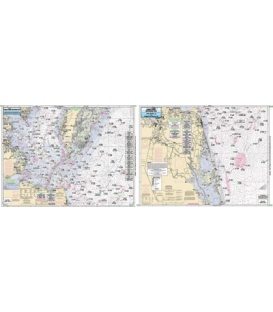
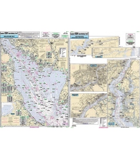
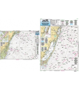
Captain Segull's Chart ODMV21 Offshore Coastal DE, MD, VA
Nearshore 20 - 30 miles off. Chart is 19 x 26 inches, double sided, and laminated. Virginia, Delaware, and Maryland
Side A: Rehoboth Bay, DE to Chincoteague, VA, with an inset of Ocean City Inlet. Side B: Chincoteague Inlet to Great Machipongo Inlet, VA, with an inset of Chincoteague Channel. All charts include wrecks, reefs, shoals, fishing areas, amenities and restrictions. Please refer CBL22, SNJ110, & CMCH20