Sign up for our Newsletter


More info
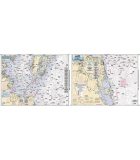
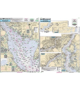
Captain Segull's Chart DEL117 Inshore - Delaware Bay (2018)
An inshore chart 1-2 miles off the coast detailing the bay. Chart is 19 x 26 inches, double sided, and laminated. Delaware Bay
Delaware Bay, Delaware River to Philadelphia, PA, C & D Canal. All charts include GPS coordinates, wrecks, reefs, shoals, fishing areas, amenities and restrictions. Also refer to CMCH20, SNJ110 & CBU120.