Sign up for our Newsletter


More info
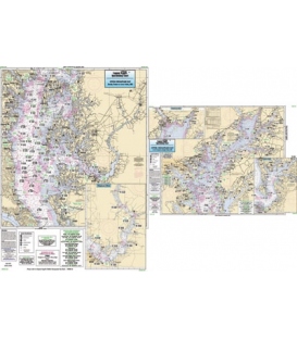
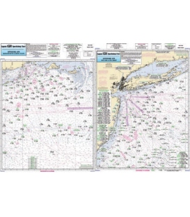
Captain Segull's Chart CBL22 Offshore Coastal Virginia to North Carolina and Lower Chesapeake Bay (2020)
Nearshore 20 - 30 miles off. Chart is 19 x 26 inches, double sided, and laminated. Virginia and North Carolina coastline.
Side A: the Chesapeake Bay entrance in Virginia as far north to Ware Neck, Old Town Neck and Hog Island Bay. Side B: from Cape Henry, VA to Currituck Beach Light, NC, with an inset of Lynnhaven Bay and Roads. All charts include wrecks, reefs, shoals, fishing areas, amenities and restrictions. Please refer to CBM119, CBU120, CHO123 or CMCH20