- Home
- >
- Nautical Books
- >
- British Admiralty
- >
- Admiralty Publications
- >
- NP5011 Symbols and Abbreviations Used on Admiralty Charts, 8th Edition 2020
Categories
- CLEARANCE
- New Editions
- Nautical Charts
- Nautical Books
- E-Readers & E-Books
- Occupational Safety & Health Administration (OSHA)
- Destinations
- Code of Federal Regulations (CFR)
- USCG Exam Study Materials
- International Maritime Org. (IMO)
- Sealite Aids to Marine Navigation
- Flags
- Digital Charts
- Nautical Software
- Marine Supplies
- Navigation Equipment
- Intracoastal Waterway
- Ocean Cruising
- Great Circle Route
- Gift Shop


Sign up for our Newsletter
More info
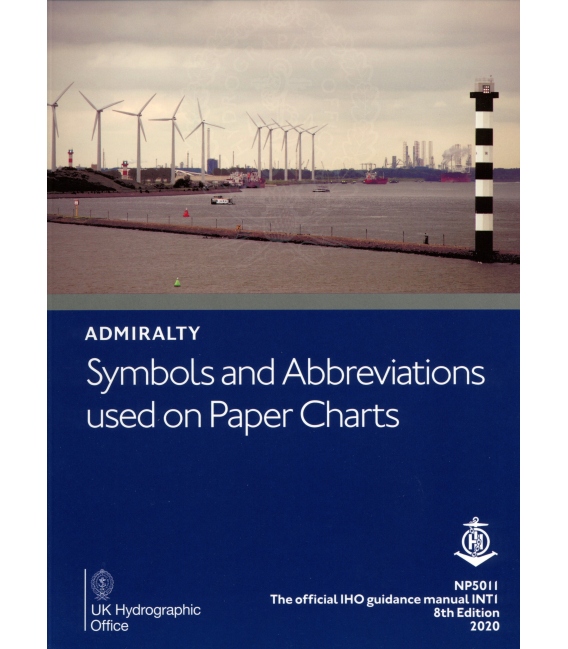
Chart 5011 Symbols and Abbreviations used on Admiralty Paper Charts, 8th Edition 2020
Chart 5011- Symbols and Abbreviations used on Admiralty Charts, is published in a convenient A4 booklet and features details of: • Admiralty and INT (from the international chart series) symbols clearly illustrated in full color • Hydrography - the nature and conditions of the seabed • Topography - natural and man-made features • Navigational aids and services • Abbreviations of principal English and foreign charts • General information on the content of Admiralty Charts
NP5011
Publication Details
- Number NP5011
- Title Symbols and Abbreviations Used on Admiralty Charts
- Sub Title n/a
- Type Related Admiralty Publications
- SubType
- Edition No 8
- Pub Year 2020
Reviews
13 other products in the same category:
Customers who bought this product also bought:
- About Us
- Our Services
- Ordering & Shipping
- Resource Links
- Blog
- CLEARANCE
- New Editions
- Nautical Charts
- Nautical Books
- E-Readers & E-Books
- Occupational Safety & Health Administration (OSHA)
- Destinations
- Code of Federal Regulations (CFR)
- USCG Exam Study Materials
- International Maritime Org. (IMO)
- Sealite Aids to Marine Navigation
- Flags
- Digital Charts
- Nautical Software
- Marine Supplies
- Navigation Equipment
- Intracoastal Waterway
- Ocean Cruising
- Great Circle Route
- Gift Shop
Accept
Maryland Nautical uses cookies to enhance your e-commerce experience. To view more information about our cookie use, click here to view our Privacy Policy.

