Sign up for our Newsletter


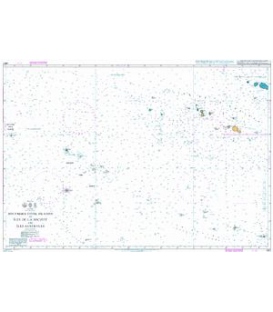
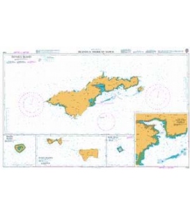
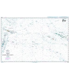
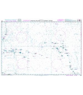
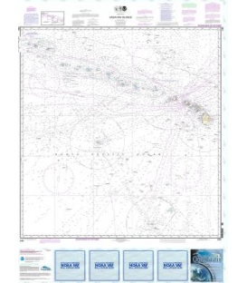
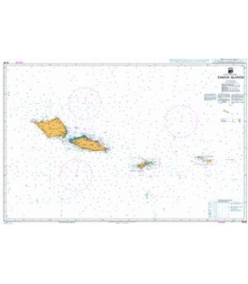
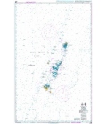
British Admiralty New Zealand Nautical Chart NZ86 Samoa Islands
*** Canceled, replaced by WS111 (overview only, no detailed plans) (NM 23/23)
More info
British Admiralty New Zealand Nautical Chart NZ86 Samoa Islands
is corrected up to date. Admiralty standard nautical charts comply with Safety of Life at Sea (SOLAS) regulations and are ideal for professional, commercial and recreational use. Charts within the series consist of a range of scales, useful for passage planning, ocean crossings, coastal navigation and entering port. Mariners should always use the largest scale nautical chart appropriate to their needs. In particularly busy seaways such as the English Channel, Gulf of Suez and the Malacca and Singapore Straits, the standard nautical charts are supplemented by mariners routeing guides which provide advice on route planning in these complex areas.
Main Chart Details
- Chart Title: Samoa Islands
- Publication Date: 01/06/2010
- Latest Edition date: 05/07/2019
- Chart Size: 981 x 627 (mm)
Chart Panel Details
- Panel Name Samoa Islands
- Area Name South Pacific Ocean
- Natural Scale 500000
- North Limit 12 28'.00S
- East Limit 168 48'.00W
- South Limit 15 18'.00S
- West Limit 173 20'.00W
- Panel Name Satupa'itea Road
- Area Name Savai'i Island
- Natural Scale 50000
- North Limit 13 45'.51S
- East Limit 172 18'.09W
- South Limit 13 47'.65S
- West Limit 172 20'.59W
- Panel Name Falealupo Road
- Area Name Savai'i Island
- Natural Scale 25000
- North Limit 13 29'.01S
- East Limit 172 46'.54W
- South Limit 13 30'.79S
- West Limit 172 48'.29W
- Panel Name Sala'ilua Bay
- Area Name Savai'i Island
- Natural Scale 50000
- North Limit 13 41'.40S
- East Limit 172 33'.78W
- South Limit 13 44'.95S
- West Limit 172 37'.12W
- Panel Name Fagali'i Bay
- Area Name Upolu Island
- Natural Scale 24270
- North Limit 13 49'.17S
- East Limit 171 43'.15W
- South Limit 13 50'.90S
- West Limit 171 44'.43W
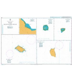
- Panel Name Vailele Bay
- Area Name Upolu Island
- Natural Scale 20050
- North Limit 13 49'.59S
- East Limit 171 41'.58W
- South Limit 13 51'.02S
- West Limit 171 43'.07W
- Panel Name Falefa Harbour
- Area Name Upolu Island
- Natural Scale 39030
- North Limit 13 51'.56S
- East Limit 171 33'.20W
- South Limit 13 54'.33S
- West Limit 171 35'.36W
- Panel Name Uafato Bay
- Area Name Upolu Island
- Natural Scale 12260
- North Limit 13 55'.60S
- East Limit 171 29'.92W
- South Limit 13 57'.00S
- West Limit 171 30'.59W
- Panel Name Safata Harbour
- Area Name Upolu Island
- Natural Scale 27920
- North Limit 13 58'.31S
- East Limit 171 49'.20W
- South Limit 14 00'.86S
- West Limit 171 52'.92W
- Panel Name Falealili Island
- Area Name Upolu Island
- Natural Scale 33300
- North Limit 14 00'.70S
- East Limit 171 39'.85W
- South Limit 14 02'.98S
- West Limit 171 42'.27W