Sign up for our Newsletter


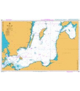
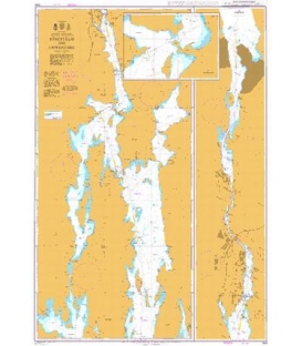
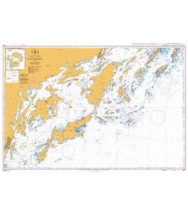
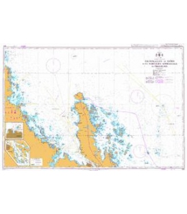
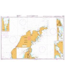
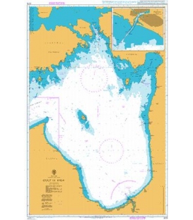
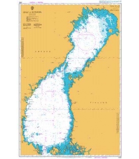
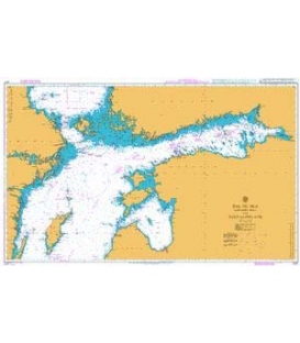
British Admiralty Nautical Chart 2817 Baltic Sea - Northern Sheet and Gulf of Finland
is corrected up to date. Admiralty standard nautical charts comply with Safety of Life at Sea (SOLAS) regulations and are ideal for professional, commercial and recreational use. Charts within the series consist of a range of scales, useful for passage planning, ocean crossings, coastal navigation and entering port. Mariners should always use the largest scale nautical chart appropriate to their needs. In particularly busy seaways such as the English Channel, Gulf of Suez and the Malacca and Singapore Straits, the standard nautical charts are supplemented by mariners routeing guides which provide advice on route planning in these complex areas.
Chart 2817
Main Chart Details
- Chart Title: Baltic Sea - Northern Sheet and Gulf of Finland
- Publication Date: 03/03/1995
- Latest Edition date: 06/2021
- Chart Size: 1065 x 640 (mm)
Chart Panel Details
- Panel Name Baltic Sea - Northern Sheet and Gulf of Finland
- Natural Scale 750000
- North Limit 61 11'.10N
- East Limit 29 20'.00E
- South Limit 56 45'.00N
- West Limit 16 10'.00E
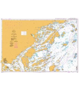
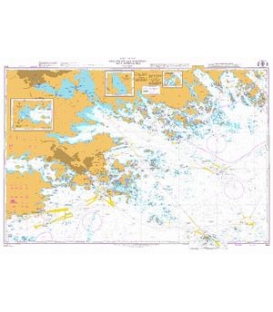
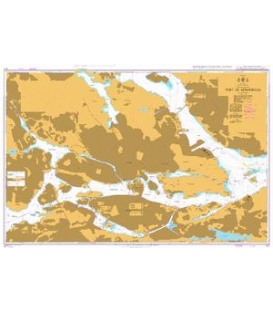
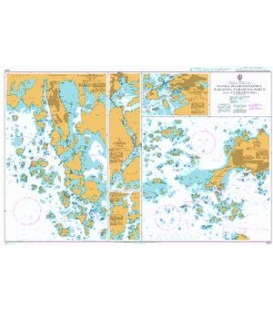
- Panel Name Continuation to Sankt Peterburg
- Area Name Baltic Sea
- Natural Scale 750000
- North Limit 60 30'.00N
- East Limit 30 30'.00E
- South Limit 59 30'.00N
- West Limit 28 30'.00E
Co-ordinates given are usually those of the four extremities of the chart. In many cases not all the area within will be fully charted*.Customers should check that the chart meets their requirements by viewing the chart image (where available).Mariners should always use the largest scale navigational chart available.
*Reasons may include
- Continuation of coverage of a small part outside the main area of chart coverage e.g a river.
- Inset plans and the chart title block and notes also take up space, therefore geographical information cannot be shown in this area.
- A need to refer to larger scale of chart, such waters are often "blued out" to avoid excessive maintenance work applying numerous NM corrections to an area of the small scale chart where the navigator will be using a larger scale chart.
- Coverage is better served from a different chart because of typical routeings.