Sign up for our Newsletter
 to Mecklenburger Bucht (150,000)")
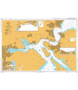
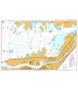
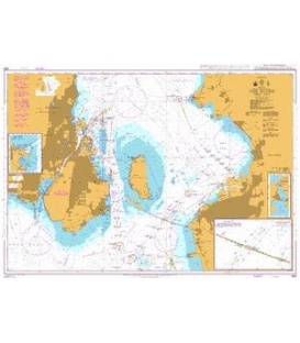
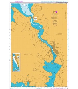
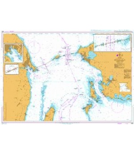
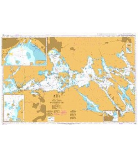
British Admiralty Nautical Chart DE30 Flensburger Forde (Flensborg Fjord) to Mecklenburger Bucht (150,000)


INT.1353, Baltic Sea, Denmark & Germany
Flensburger Forde (Flensborg Fjord) to Mecklenburger Bucht (150,000)
(Published jointly by the UKHO and the German Hydrographic Office)
Edition date: 06/2023
British Admiralty Nautical Chart DE30 Flensburger Forde (Flensborg Fjord) to Mecklenburger Bucht (150,000)
is corrected up to date. Admiralty standard nautical charts comply with Safety of Life at Sea (SOLAS) regulations and are ideal for professional, commercial and recreational use. Charts within the series consist of a range of scales, useful for passage planning, ocean crossings, coastal navigation and entering port. Mariners should always use the largest scale nautical chart appropriate to their needs. In particularly busy seaways such as the English Channel, Gulf of Suez and the Malacca and Singapore Straits, the standard nautical charts are supplemented by mariners routeing guides which provide advice on route planning in these complex areas.