- Home
- >
- Nautical Books
- >
- By Publisher
- >
- Brown, Son & Ferguson
- >
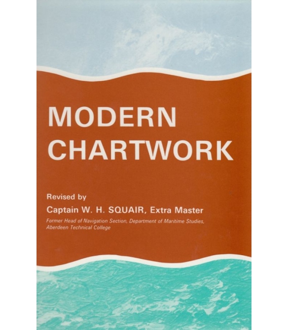
- Modern Chartwork By Capt W.H. Squair
Categories
- CLEARANCE
- New Editions
- Nautical Charts
- Nautical Books
- E-Readers & E-Books
- Occupational Safety & Health Administration (OSHA)
- Destinations
- Code of Federal Regulations (CFR)
- USCG Exam Study Materials
- International Maritime Org. (IMO)
- Sealite Aids to Marine Navigation
- Flags
- Digital Charts
- Nautical Software
- Marine Supplies
- Navigation Equipment
- Intracoastal Waterway
- Ocean Cruising
- Great Circle Route
- Gift Shop


Sign up for our Newsletter
BRMC
New product
ISBN:978-0-85174-548-0 (9780851745480)
Published date:First published 1923-6th edition 1992
*** 8Jun20, Out of Print and no plans to reprint.
Modern Chartwork By Capt W.H. Squair
The revision of this work has been of a comprehensive nature. New matter is included and existing text updated as necessary.
Mercator's and Gnomonic Projections are explained and the use of each illustrated. Information shown on charts and relevant abbreviations used are explained.
Basic geographical directions are expanded into courses and bearings as laid-down and taken-off in chartwork.
The standard type of chart-use is explained through coastal navigation to ocean passage navigation.
The tremendous assistance of modern electronic-type navigation, including navigation using satellites, is described at some length.
The traditional skills of hands-on working on a coastal chart is, of necessity, given prominence in the book. A considerable number of worked examples are followed by similar examples for exercise.
A copy of abbreviations likely to be found on charts is included.
Reviews
30 other products in the same category:
- About Us
- Our Services
- Ordering & Shipping
- Resource Links
- Blog
- CLEARANCE
- New Editions
- Nautical Charts
- Nautical Books
- E-Readers & E-Books
- Occupational Safety & Health Administration (OSHA)
- Destinations
- Code of Federal Regulations (CFR)
- USCG Exam Study Materials
- International Maritime Org. (IMO)
- Sealite Aids to Marine Navigation
- Flags
- Digital Charts
- Nautical Software
- Marine Supplies
- Navigation Equipment
- Intracoastal Waterway
- Ocean Cruising
- Great Circle Route
- Gift Shop

