Sign up for our Newsletter


Murphy's Deck Officer Study Guide Vol. 5: Navigation Problems 2011-2012
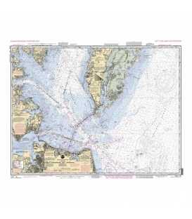
Vol.5: Navigation Problems 2011/2012 Edition Publisher: Academy Publishing Company by Captain Joseph S. Murphy, II U.S. Coast Guard License Examination Preparation for the Professional Mariner PART 1 - OCEAN TRACK PLOTTING • Mid - Latitude Sailing • Mercator Sailing • Parallel Sailing • Great Circle Sailing • Voyage Planning (Composite Sailing) • Estimated Time of Arrival PART 2 - CELESTIAL OBSERVATIONS • Observed Altitude (HO) • Latitude by Polaris • Latitude by Meridian Transit (Upper Transit) • Latitude by Ex-Meridian (Upper Transit) • Latitude by Ex-Meridian (Lower Transit) • Sight Reduction • Fix & Running Fix • Star & Planet Identification at the time of Observation • Star & Selection at the time of Civil Twilight • Time of Meridian Transit at Upper Transit • Time of Celestial Phenomena • Compass Error by Celestial Observation - Azimuth • Compass Error by Celestial Observation - Amplitude PART 3 - TERRESTRIAL OBSERVATIONS PILOTING - CHART PILOT EXERCISES MANAGEMENT LEVEL - CHIEF MATE/OICNW OCEANS & NEAR COASTAL • Chesapeake Bay Entrance & Approaches (Chart No. 12221-TR) • Long Island Sound - Eastern Part (Chart No. 12354-TR) • Block Island Sound & Approaches (Chart No. 13205-TR) PILOTING - CHART PILOT EXERCISES OPERATIONAL LEVEL - THIRD MATE/OICNW-AGT MASTER/MATE200, 500 - 1600 GROSS TONS, OPERATOR, UNINSPECTED TOWING VESSELS - INLAND & NEAR COASTAL • Chesapeake Bay Entrance & Approaches (Chart No. 12221-TR) • Long Island Sound - Eastern Part (Chart No. 12354-TR) • Block Island Sound & Approaches (Chart No. 13205-TR) LIMITED LICENSE - OPERATOR, UNINSPECTED PASSENGER VESSELS, MASTER/MATE 100 - 200 GROSS TONS - INLAND & NEAR COASTAL • Chesapeake Bay Entrance & Approaches (Chart No. 12221-TR) • Long Island Sound - Eastern Part (Chart No. 12354-TR) • Block Island Sound & Approaches (Chart No. 13205-TR) • Corps of Engineers Mississippi River Maps - Cairo to the Gulf • Columbia River (Chart No. 18531) • Special Case Bearing Problems • Bearing Problems • Fix, Running Fix & Dead Reckoning Problems • Fuel Conservation & Speed by Revolutions • Set & Drift • Compass Error • Deviation Table Construction and Use • Course Determination (Compass Error/Leeway) PART 4 - ELECTRONIC NAVIGATION • Electronic Navigation - Radio direction Finder • Electronic Navigation - Radio Time Signal ISBN: 18813490505
Please note: all the textbooks are final sale item and cannot be returned or exchanged.