- Home
- >
- Nautical Charts
- >
- Imray-Iolaire Nautical Charts
- >
- Mediterranean Region
- >
- Imray Chart M33: Adriatic Italy (North)
Categories
- CLEARANCE
- New Editions
- Nautical Charts
- Nautical Books
- E-Readers & E-Books
- Occupational Safety & Health Administration (OSHA)
- Destinations
- Code of Federal Regulations (CFR)
- USCG Exam Study Materials
- International Maritime Org. (IMO)
- Sealite Aids to Marine Navigation
- Flags
- Digital Charts
- Nautical Software
- Marine Supplies
- Navigation Equipment
- Intracoastal Waterway
- Ocean Cruising
- Great Circle Route
- Gift Shop


Sign up for our Newsletter
II-M033
New product
Online Chart Viewer
Stock code ICM33-2
Author Imray
Publisher Imray
ISBN 9781846237010
Edition date 2015
Printed and corrected to September 2015
Publication details Sheet size 640 x 900mm. Waterproof. Folded in plastic wallet or flat.
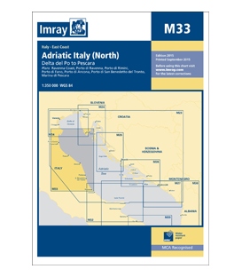
M33 Adriatic Italy (North)
M33 Adriatic Italy (North)
Delta del Po to Pescara
Scale: 1:350 000 WGS 84
Imray
Plans included:
Ravenna Coast (1:50 000)
Porto di Ravenna (1:20 000)
Porto di Rimini (1:10 000)
Porto di Fano (1:7500)
Porto di Ancona (1:25 000)
Porto di San Benedetto del Tronto (1:10 000)
Marina di Pescara (1:15 000)
For this 2015 edition the chart has been fully updated throughout showing revised depths where required. Various harbour developments are shown at Porto di Ravenna, Porto di Rimini, Porto di Ancona and Marina di Pescara. The plan of Ancona Coast has been removed and replaced with two new harbour plans - Porto di Fano and Porto di San Benedetto del Tronto. The sketch plan of Pescara has been replaced with a fully georeferenced WGS84-compatible plan.
Reviews
30 other products in the same category:
Customers who bought this product also bought:
- About Us
- Our Services
- Ordering & Shipping
- Resource Links
- Blog
- CLEARANCE
- New Editions
- Nautical Charts
- Nautical Books
- E-Readers & E-Books
- Occupational Safety & Health Administration (OSHA)
- Destinations
- Code of Federal Regulations (CFR)
- USCG Exam Study Materials
- International Maritime Org. (IMO)
- Sealite Aids to Marine Navigation
- Flags
- Digital Charts
- Nautical Software
- Marine Supplies
- Navigation Equipment
- Intracoastal Waterway
- Ocean Cruising
- Great Circle Route
- Gift Shop
Maryland Nautical uses cookies to enhance your e-commerce experience. To view more information about our cookie use, click here to view our Privacy Policy.


