Sign up for our Newsletter


More info
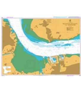
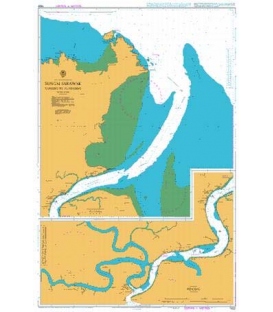
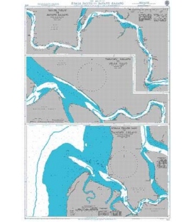
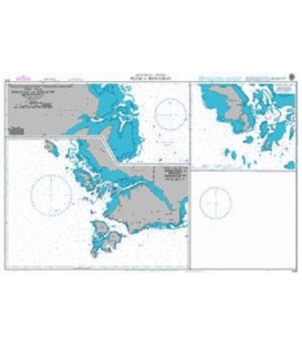
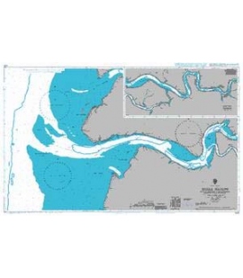
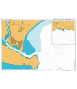
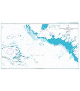
Indonesia, Kalimantan - East Coast: Pelabuhan Loktuan and Pelabuhan Bontang and Approaches
Co-ordinates given are usually those of the four extremities of the chart. In many cases not all the area within will be fully charted*.Customers should check that the chart meets their requirements by viewing the chart image (where available).Mariners should always use the largest scale navigational chart available.
Chart 3051
Main Chart Details
- Chart Title: Pelabuhan Loktuan and Pelabuhan Bontang and Approaches
- Publication Date: 01/03/2012
- Latest Edition date: 01/04/2021
- Chart Size: 1120 x 650 (mm)
Chart Panel Details
- Panel Name Plan A - Pelabuhan Loktuan
- Area Name Kalimantan - East Coast
- Natural Scale 10000
- North Limit 0 11'.40N
- East Limit 117 30'.94E
- South Limit 0 09'.72N
- West Limit 117 29'.00E
- Panel Name Plan B - Pelabuhan Bontang
- Area Name Kalimantan - East Coast
- Natural Scale 10000
- North Limit 0 06'.24N
- East Limit 117 30'.80E
- South Limit 0 04'.45N
- West Limit 117 28'.05E
- Panel Name Plan C - Approaches to Pelabuhan Loktuan and Pelabuhan Bontang
- Area Name Kalimantan - East Coast
- Natural Scale 30000
- North Limit 0 11'.50N
- East Limit 117 37'.68E
- South Limit 0 00'.91N
- West Limit 117 28'.00E