Sign up for our Newsletter


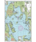
Imray Chart G40: Kas to Antalya
Online Chart Viewer
Stock code: ICG40-1
Author: Imray
Publisher: Imray
ISBN: 9781846236297
Edition:
Edition date: 2014
Last printed: June 2014
Publication details: Sheet size 640 x 900mm. Waterproof. Folded in plastic wallet or flat.
More info
G40 Kas to Antalya
Scale: 1:200,000 WGS 84
Imray
Plans included:
Kekova Roads (1:40 000)
Kekova Adasi (1:15 000)
Finike (1:17 500)
Antalya Celebi Marina (1:15 000)
Kemer Turkiz Marina (1:17 500)
For this 2014 edition the chart has been fully updated and modernised. The latest known depths are shown around Kas, Kekova Roads and Antalya Harbour. Harbour depths at Üçagiz are also displayed, as are the recently deployed AIS transmitters across the chart.