- Home
- >
- Nautical Books
- >
- Canadian Hydrographic
- >
- Canadian Hydrographic Sailing Directions
- >
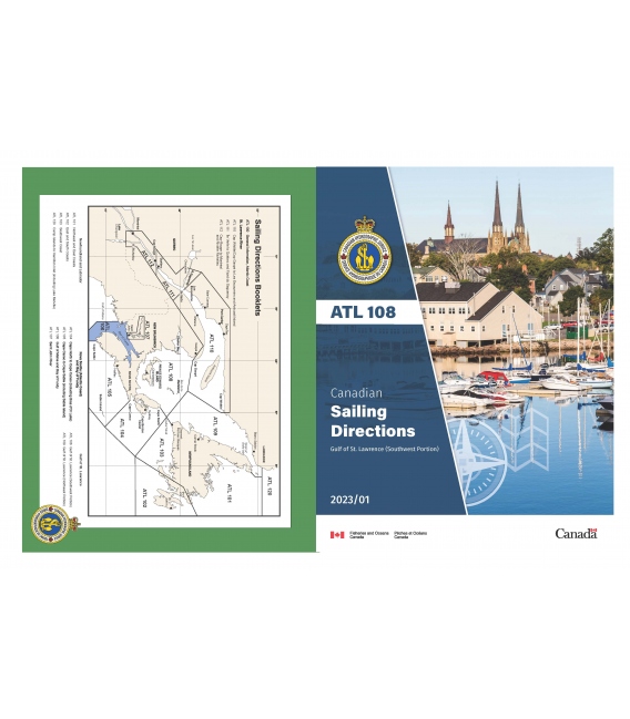
- ATL108E: Gulf of St. Lawrence (Southwest Portion), 2023
Categories
- CLEARANCE
- New Editions
- Nautical Charts
- Nautical Books
- E-Readers & E-Books
- Occupational Safety & Health Administration (OSHA)
- Destinations
- Code of Federal Regulations (CFR)
- USCG Exam Study Materials
- International Maritime Org. (IMO)
- Sealite Aids to Marine Navigation
- Flags
- Digital Charts
- Nautical Software
- Marine Supplies
- Navigation Equipment
- Intracoastal Waterway
- Ocean Cruising
- Great Circle Route
- Gift Shop


Sign up for our Newsletter
CNSD-ATL108E
New product
ATL108E: Gulf of St. Lawrence (Southwest Portion), 2023
This Second Edition of Sailing Directions, ATL 108 — Gulf of St. Lawrence (Southwest Portion), 2021, has been compiled
from Canadian Government and other information sources. All hydrographic terms used in this booklet are in accordance
with the meanings given in the Hydrographic Dictionary (Special Publication No. 32), published by the International Hydrographic Organization.
General information for the Atlantic Coast is grouped within one booklet, Sailing Directions, ATL 100 — General Information,
Atlantic Coast, 2007. It contains navigational information and a brief description of the main port facilities as well as
geographic, oceanographic and atmospheric characteristics.
The detailed description of the geographical areas is given in a series of booklets. Their limits are printed on the back
cover of the booklets. The appropriate descriptive booklet(s) should be consulted in conjunction with the ATL 100
— General Information booklet.
Tide, water level and current information has been revised by the Tides, Currents and Water Levels Division of the Canadian
Hydrographic Service.
The photographs are by Fisheries and Oceans Canada. The photograph for the Port of Belledune is courtesy of the Port
of Belledune Authority.
Reviews
30 other products in the same category:
Customers who bought this product also bought:
- About Us
- Our Services
- Ordering & Shipping
- Resource Links
- Blog
- CLEARANCE
- New Editions
- Nautical Charts
- Nautical Books
- E-Readers & E-Books
- Occupational Safety & Health Administration (OSHA)
- Destinations
- Code of Federal Regulations (CFR)
- USCG Exam Study Materials
- International Maritime Org. (IMO)
- Sealite Aids to Marine Navigation
- Flags
- Digital Charts
- Nautical Software
- Marine Supplies
- Navigation Equipment
- Intracoastal Waterway
- Ocean Cruising
- Great Circle Route
- Gift Shop
Maryland Nautical uses cookies to enhance your e-commerce experience. To view more information about our cookie use, click here to view our Privacy Policy.

