Sign up for our Newsletter
, 2023 Edition")
, 2023 Edition")
, 2023 Edition")
, 2023 Edition")
, 2023 Edition")
, 2023 Edition")
More info
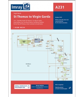
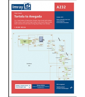
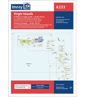
Imray Chart A233 Virgin Islands (A231 and A232), 2023 Edition
-
Plans included:
Charlotte Amalie (St Thomas) (1:30 000)
Cruz Bay (St John) (1:20 000)
Road Harbour, Sea Cow Bay & Nanny Cay Marina (Tortola) (1:20 000)
Benner Bay (St Thomas) (1:30 000)
Great Camanoe to Scrub Island (1:20 000)
Road Harbour & Approaches (Tortola) (1:20 000)
Virgin Gorda Yacht Harbour (Virgin Gorda) (1:20 000)
South Sound (Virgin Gorda) (1:20 000)
Gorda Sound (Virgin Gorda) (1:25 000)
Fat Hogs Bay & Maya Cove (Tortola) (1:20 000)
Imray-Iolaire charts for the Caribbean are widely acknowledged as the best available for the cruising sailor. They combine the latest official survey data with first-hand information gathered over 60 years of research by Don Street Jr and his wide network of contributors. Like all Imray charts, they are printed on water resistant Pretex paper for durability, and they include many anchorages, facilities and inlets not included on official charts.
This edition includes the latest official data combined with additional information sourced from Imray''s network to make it ideal for small craft. It includes the latest official bathymetric surveys. There has been general updating throughout.