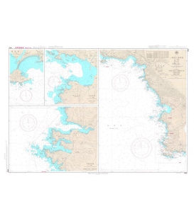
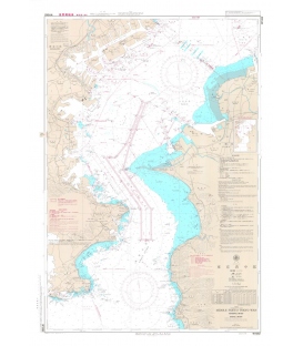
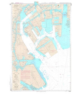
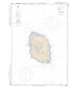
Japanese official paper charts published by the Japan Coast Guard (JCG). All W charts are written in bilingual, Japanese and English. The color of land is printed in grey. Edition Feb-19, Scale 23,000, Chart Dimensions 1,085mmx765mm
Maryland Nautical uses cookies to enhance your e-commerce experience. To view more information about our cookie use, click here to view our Privacy Policy.