Sign up for our Newsletter


More info
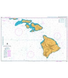
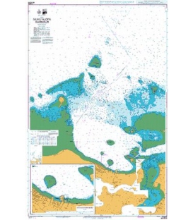
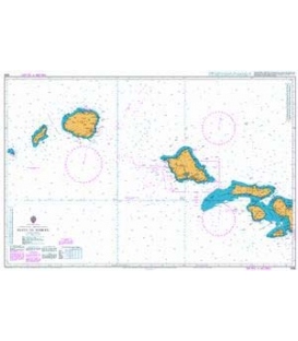
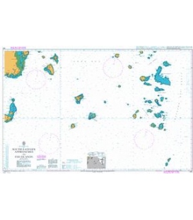
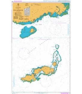
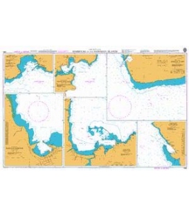
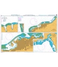
British Admiralty Nautical Chart 1490 Harbours in the Hawaiian Islands
is corrected up to date. Admiralty standard nautical charts comply with Safety of Life at Sea (SOLAS) regulations and are ideal for professional, commercial and recreational use. Charts within the series consist of a range of scales, useful for passage planning, ocean crossings, coastal navigation and entering port. Mariners should always use the largest scale nautical chart appropriate to their needs. In particularly busy seaways such as the English Channel, Gulf of Suez and the Malacca and Singapore Straits, the standard nautical charts are supplemented by mariners routeing guides which provide advice on route planning in these complex areas.
Chart 1490
Main Chart Details
- Chart Title: Harbours in the Hawaiian Islands
- Publication Date: 25/09/1970
- Latest Edition date: 13/12/1985
- Chart Size: 980 x 605 (mm)
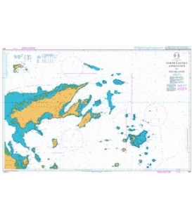
Chart Panel Details
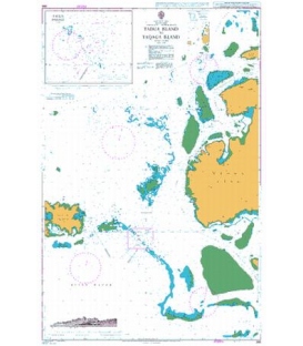
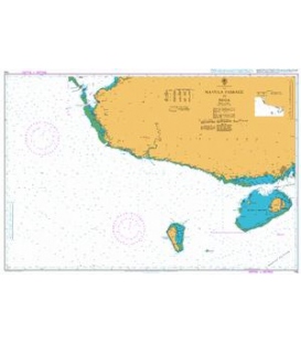
- Panel Name Barbers Point
- Area Name Oahu Island
- Natural Scale 25000
- North Limit 21 20'.00N
- East Limit 158 02'.75W
- South Limit 21 15'.20N
- West Limit 158 08'.83W
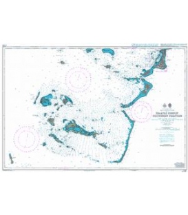
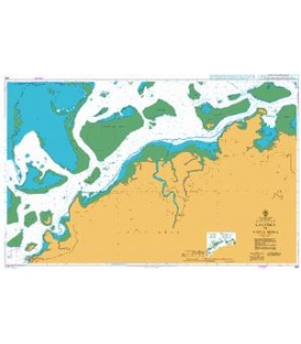
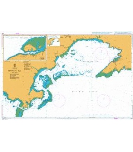
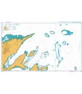
- Panel Name Kahului Harbour and Approaches
- Area Name Maui Island
- Natural Scale 12500
- North Limit 20 55'.97N
- East Limit 156 27'.72W
- South Limit 20 53'.33N
- West Limit 156 29'.97W
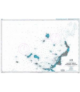
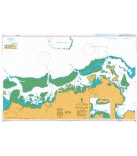
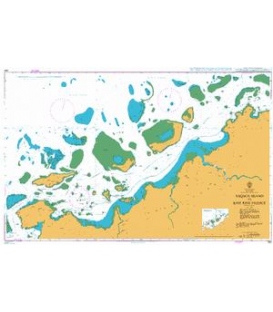
- Panel Name Hilo Bay
- Area Name Hawaii Island
- Natural Scale 15000
- North Limit 19 46'.07N
- East Limit 155 02'.47W
- South Limit 19 43'.10N
- West Limit 155 05'.80W
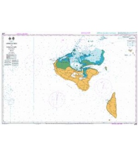
- Panel Name Kawaihae
- Area Name Hawaii Island
- Natural Scale 15000
- North Limit 20 03'.50N
- East Limit 155 49'.28W
- South Limit 20 01'.53N
- West Limit 155 51'.50W
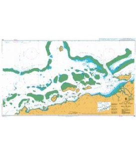
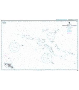
- Panel Name Nawiliwili Bay
- Area Name Kauai Island
- Natural Scale 15000
- North Limit 21 57'.95N
- East Limit 159 19'.55W
- South Limit 21 56'.08N
- West Limit 159 21'.95W
- Panel Name Port Allen
- Area Name Kauai Island
- Natural Scale 10000
- North Limit 21 54'.47N
- East Limit 159 34'.98W
- South Limit 21 53'.35N
- West Limit 159 36'.50W