Sign up for our Newsletter


More info
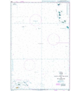
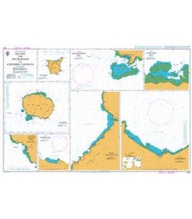
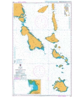
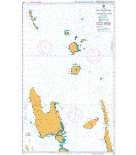
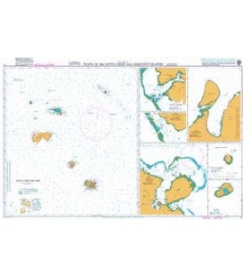
British Admiralty Nautical Chart 17 Plans of the Santa Cruz and Adjacent Islands
is corrected up to date. Admiralty standard nautical charts comply with Safety of Life at Sea (SOLAS) regulations and are ideal for professional, commercial and recreational use. Charts within the series consist of a range of scales, useful for passage planning, ocean crossings, coastal navigation and entering port. Mariners should always use the largest scale nautical chart appropriate to their needs. In particularly busy seaways such as the English Channel, Gulf of Suez and the Malacca and Singapore Straits, the standard nautical charts are supplemented by marinersÕ routeing guides which provide advice on route planning in these complex areas.
Chart 17
Main Chart Details
- Chart Title: Plans of the Santa Cruz and Adjacent Islands
- Publication Date: 14/08/1992
- Latest Edition date: 14/08/1992
- Chart Size: 1000 x 625 (mm)
Chart Panel Details
- Panel Name Plans of the Santa Cruz and Adjacent Islands
- Area Name Santa Cruz Islands
- Natural Scale 500000
- North Limit 9 25'.00S
- East Limit 167 48'.00E
- South Limit 12 13'.37S
- West Limit 165 14'.51E
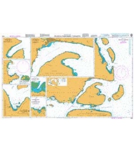
- Panel Name Basilisk Harbour
- Area Name Utupua I
- Natural Scale 50000
- North Limit 11 14'.70S
- East Limit 166 31'.97E
- South Limit 11 19'.59S
- West Limit 166 26'.61E
- Panel Name Pallu Passage
- Area Name Vanikolo Island
- Natural Scale 50000
- North Limit 11 40'.60S
- East Limit 166 52'.57E
- South Limit 11 43'.92S
- West Limit 166 47'.20E
- Panel Name Graciosa Bay
- Area Name Ndendo Island
- Natural Scale 50000
- North Limit 10 37'.65S
- East Limit 165 51'.94E
- South Limit 10 46'.17S
- West Limit 165 45'.90E
- Panel Name Manieve and Tevai Bays
- Area Name Vanikolo Island
- Natural Scale 50000
- North Limit 11 32'.80S
- East Limit 167 01'.60E
- South Limit 11 40'.94S
- West Limit 166 53'.82E
- Panel Name Anuta or Cherry Island
- Natural Scale 25000
- North Limit 11 35'.70S
- East Limit 169 51'.72E
- South Limit 11 37'.65S
- West Limit 169 49'.90E
- Panel Name Tikopia Island
- Natural Scale 50000
- North Limit 12 16'.70S
- East Limit 168 51'.54E
- South Limit 12 20'.64S
- West Limit 168 47'.90E