Sign up for our Newsletter


More info
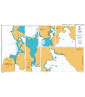
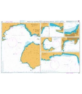
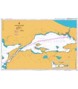
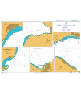
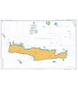
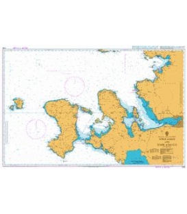
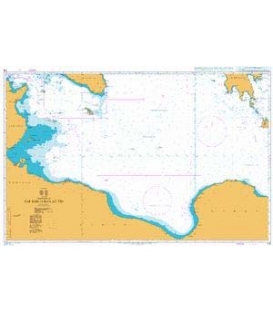
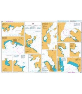
British Admiralty Nautical Chart 2402 Harbours in the Ionian Sea
is corrected up to date. Admiralty standard nautical charts comply with Safety of Life at Sea (SOLAS) regulations and are ideal for professional, commercial and recreational use. Charts within the series consist of a range of scales, useful for passage planning, ocean crossings, coastal navigation and entering port. Mariners should always use the largest scale nautical chart appropriate to their needs. In particularly busy seaways such as the English Channel, Gulf of Suez and the Malacca and Singapore Straits, the standard nautical charts are supplemented by mariners routeing guides which provide advice on route planning in these complex areas.
Chart 2402
Main Chart Details
- Chart Title: Harbours in the Ionian Sea
- Publication Date: 13/01/1995
- Latest Edition date: 13/01/1995
- Chart Size: 980 x 605 (mm)
Chart Panel Details
- Panel Name Ormos Fiskardho
- Area Name Nisos Kefallinia
- Natural Scale 7500
- North Limit 38 27'.95N
- East Limit 20 35'.27E
- South Limit 38 27'.25N
- West Limit 20 34'.53E
- Panel Name Lakka
- Area Name Nisos Paxoi
- Natural Scale 7500
- North Limit 39 14'.92N
- East Limit 20 08'.16E
- South Limit 39 14'.07N
- West Limit 20 07'.49E
- Panel Name Lixourion
- Area Name Nisos Kefallinia
- Natural Scale 7500
- North Limit 38 12'.58N
- East Limit 20 26'.81E
- South Limit 38 11'.87N
- West Limit 20 26'.24E
- Panel Name Ormos Longos
- Area Name Nisos Paxoi
- Natural Scale 7500
- North Limit 39 14'.16N
- East Limit 20 10'.55E
- South Limit 39 13'.30N
- West Limit 20 09'.60E
- Panel Name Ormos Platiyiali
- Area Name Greece - West Coast
- Natural Scale 15000
- North Limit 38 29'.06N
- East Limit 21 06'.35E
- South Limit 38 27'.35N
- West Limit 21 04'.79E
- Panel Name Ormos Pargas
- Area Name Greece - West Coast
- Natural Scale 7500
- North Limit 39 17'.39N
- East Limit 20 24'.57E
- South Limit 39 16'.53N
- West Limit 20 23'.13E
- Panel Name Limin Paxon
- Area Name Nisos Paxoi
- Natural Scale 7500
- North Limit 39 12'.64N
- East Limit 20 12'.18E
- South Limit 39 11'.48N
- West Limit 20 11'.13E
- Panel Name Limin Alipa
- Area Name Nisos Kerkira
- Natural Scale 10000
- North Limit 39 40'.77N
- East Limit 19 43'.79E
- South Limit 39 39'.89N
- West Limit 19 41'.91E
- Panel Name Ormos Kioni
- Area Name Nisos Ithaki
- Natural Scale 10000
- North Limit 38 27'.41N
- East Limit 20 42'.34E
- South Limit 38 26'.48N
- West Limit 20 41'.37E
- Panel Name Vasiliki
- Area Name Nisos Levkas
- Natural Scale 10000
- North Limit 38 38'.23N
- East Limit 20 36'.70E
- South Limit 38 37'.30N
- West Limit 20 35'.52E
- Panel Name Kolpos Aetou
- Area Name Nisos Ithaki
- Natural Scale 20000
- North Limit 38 24'.33N
- East Limit 20 44'.00E
- South Limit 38 21'.73N
- West Limit 20 40'.00E
- Panel Name Ormos Argostoliou
- Area Name Nisos Kefallinia
- Natural Scale 20000
- North Limit 38 13'.18N
- East Limit 20 30'.19E
- South Limit 38 10'.32N
- West Limit 20 27'.69E
- Panel Name Ormos Vlikho
- Area Name Nisos Levkas
- Natural Scale 25000
- North Limit 38 43'.91N
- East Limit 20 44'.74E
- South Limit 38 39'.45N
- West Limit 20 41'.60E