Sign up for our Newsletter
 (Jun 2024)")
 (Jun 2024)")
More info
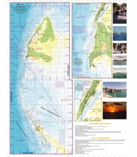
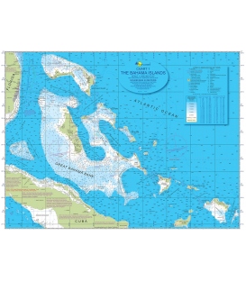
Explorer Chart No. 1 (Bahama Islands) (Jun 2024)
Updated June 2024
The best-ever intuitively colored chart of the entire Bahamas chain, including the Turks and Caicos. Cartography you trust by The Explorer team of Monty Lewis and Kate Fears.
Special Features including:
18″x24″
Waterproof/tearproof
Suitable for framing (shipped unfolded in a tube)
Excellent for overall planning
Showing magenta routes of longer passages
Perfect for family or friends to follow your route
Small-scale (1:1,750,000) from Ft. Pierce, FL to Great Inagua
Including Turks and Caicos Islands, Cuba, the Cay Sal Bank, and the Cochinos Bank
Containing table of nautical symbols, abbreviations, and terms