Sign up for our Newsletter


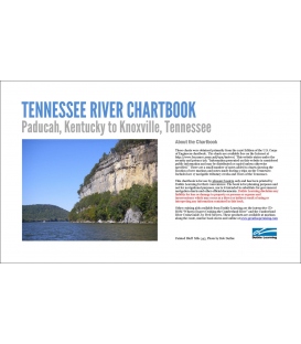
Tennessee River Chartbook: Paducah, Kentucky to Knoxville, Tennessee
The Corps of Engineers stopped selling this chartbook 3 years ago and has no plan or budget to allow sales to resume. The books are the same dimensions as the original so the map scale can be used. The maps are in color and include the bridge and overhead wire information. The covers are heavy paper.
These charts were obtained primarily from the 1996 Edition of the U.S. Corps of Engineers chartbook. The charts are available free on the internet http://www.lrn.usace.army.mil/opn/tnriver/ This website states under the security and privacy tab, "Information presented on this website is considered public information and may be distributed or copied unless otherwise specified," There are a small number of notes added to charts showing the location of new marinas and notes made during 3 trips on the Tennessee. These may give the appearance the publication is used, but they were added by the publisher as a result of these trips prior to the book being reprinted. Included are 17 navigable tributary creeks and rivers of the Tennessee.
This chartbook is for use by pleasure boaters only and has been printed by Duthie Learning for their convenience. The book is for planning purposes and not for navigational purpose, nor is it intended to substitute for government navigation charts and other official documents. Duthie Learning disclaims any liability for loss or damage to property or persons or expense and inconvenience which may occur as a direct or indirect result of using or interpreting any information contained in this book.
Other cruising aids available from Duthie Learning are the interactive CD-ROM "What to Expect Cruising the Cumberland River" and the Cumberland River CruiseGuide, by Fred Meyers. These products are available arty Marinas along the route, Marine book stores and online.