Sign up for our Newsletter
")
")
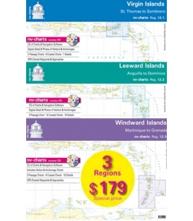
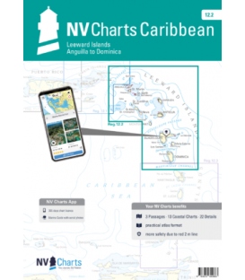
Region 12.2: Leeward Islands, Anguilla to Dominica (2025)
2025 edition
ISBN 978-3-932414-54-1
NV Charts Reg. 12.2, Leeward Islands, Anguilla to Dominica
Format: Kombipack Paper / Digital download and App
- 3 Passage Charts
- 13 Coastal Charts & 16 Details
- Charts Paper and Digital
- Digital Details & Photos of Harbors and Anchorages
The NV Charts are characterized by fine contours and easy to distinguish color graduations of the depth lines – turquoise for coral reefs, red for the 2-meter-line and blue for the 5-m-areas.
Presented in a handy, user friendly size, (23½’’ x 16 ½’’, 11.7 x 16.5 folded) a thick plastic envelope protects the charts, enabling them to be easily stored.
The importance of good graphical representation of the topography when sailing in the Caribbean is essential.
Well marked rivers, towns and street plans all help to give a clear overall view of the shoreside facilities of the islands. Red numbered waypoints with coordinates based on WGS 84 enable yachtsmen to navigate using their GPS instruments. Heights and depths are given in the internationally accepted format of meters. Large scale approaches and land contour markings simplify the entrance into anchorages.
Passage Charts
- C1 Leeward Islands 1: 900.000
- C2 Anguilla to Antigua 1: 500.000
- C3 Antigua to Martinique 1: 500.000
Coastal Charts
- C4 Anguilla to St. Martin 1: 90,000
- C5 St. Martin to St. Barth 1: 90,000
- C6 St. Eustatius to St. Kitts 1: 90,000
- C7 St. Kitts to Nevis 1: 90,000
- C8A Redonda & Montserrat 1: 90,000
- C8B Saba & Saba Bank 1: 60,000
- C9 Barbuda 1: 90,000
- C10 Antigua 1: 90,000
- C11 Guadeloupe · North 1: 90,000
- C12 Guadeloupe · Southwest 1: 90,000
- C13 Guadeloupe · Southeast 1: 90,000
- C14 Guadeloupe · East 1: 90,000
- C15 Dominica 1: 90,000
Detail Charts
- C16A Anguilla · Road Bay 1: 15,000
- C16B St. Barth · Port de Gustavia 1: 15,000
- C17 St. Martin · Simpson Bay 1: 25,000
- C18 Guadeloupe · Rivière Salée 1: 40,000
- C19A Anse Deshaies 1: 10,000
- C19B Marina Rivière Sens 1: 10,000
- C19C Pointe-à-Pitre · Marina Bas-du-Fort 1: 10,000
- C19D Marina St. François 1: 10,000
- C19E Marie-Galante · Grand-Bourg 1: 10,000
- C19F St. Kitts · Basseterre 1: 20.000
- C20 Les Saintes 1: 20,000
- C21 Antigua · North Sound 1: 35,000
- C22A Antigua · Nonsuch Bay 1: 20,000
- C22B Barbuda · South Sound 1: 20,000
- C23A Antigua · Jolly Harbour 1: 15,000
- C23B Antigua · Falmouth & English Hbr. 1: 15,000
Legend · General Notes p.24