Sign up for our Newsletter


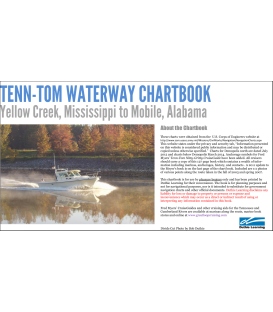
Tenn-Tom Waterway Chartbook Yellow Creek, Mississippi to Mobile, Alabama
The Tenn-Tom Waterway Chartbook covers the waterway from Yellow Creek Mississippi to Mobile, Alabama. The chartbook contains 178 full size, color reproductions. The book is spiral bound along the 14 inch edge with the left page used for photos and other data and the right page contains the charts. While the Corps of Engineers used to sell two books to cover the waterway this book has the entire waterway in a single volume. However, it does not contain the Black Warrior river charts north of Demopolis.
The Tenn-Tom Waterway Chartbook covers the waterway from Yellow Creek Mississippi to Mobile, Alabama.. The chartbook contains 178 full size, color reproductions. The book is spiral bound along the 14 inch edge with the left page used for photos and other data and the right page contains the charts. While the Corps of Engineers used to sell two books to cover the waterway this book has the entire waterway in a single volume. However, it does not contain the Black Warrior river charts north of Demopolis.
These charts were obtained from the U.S. Corps of Engineers website at
http://www.sam.usace.army.mil/Missions/CivilWorks/Navigation/NavigationCharts.aspx This website states under the privacy and security tab, “Information presented on this website is considered public information and may be distributed or copied unless otherwise specified.” Charts for Demopolis north are dated July 2012 and charts below Demopolis March 2014. Anchorage symbols for Fred Myers’ Tenn-Tom Nitty-Gritty CruiseGuide have been added. A 2011 update to the Meyer’s book is on the last page of the chart book. Included are 111 photos of various points along the route taken in the fall of 2003 and spring 2007.
This chartbook is for use by pleasure boaters only and has been printed by Duthie Learning for their convenience. The book is for planning purposes and not for navigational purposes, nor is it intended to substitute for government navigation charts and other official documents.